MyTopo
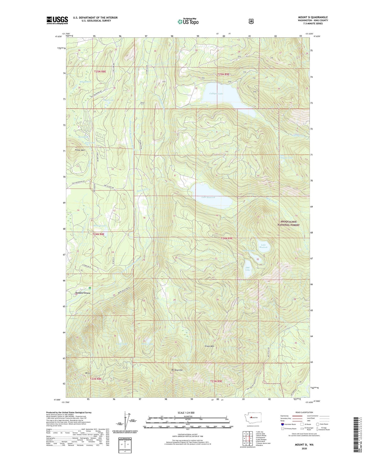
Mount Si Washington US Topo Map
Couldn't load pickup availability
Also explore the Mount Si Forest Service Topo of this same quad for updated USFS data
2023 topographic map quadrangle Mount Si in the state of Washington. Scale: 1:24000. Based on the newly updated USGS 7.5' US Topo map series, this map is in the following counties: King. The map contains contour data, water features, and other items you are used to seeing on USGS maps, but also has updated roads and other features. This is the next generation of topographic maps. Printed on high-quality waterproof paper with UV fade-resistant inks.
Quads adjacent to this one:
West: Snoqualmie
Northwest: Lake Joy
North: Devils Slide
Northeast: Mount Phelps
East: Lake Philippa
Southeast: Bandera
South: Chester Morse Lake
Southwest: North Bend
This map covers the same area as the classic USGS quad with code o47121e6.
Contains the following named places: Calligan Creek, Calligan Lake, Crater Lake, Ernies Grove, Fuller Mountain, Fury Lake, Green Mountain, Hancock Creek, Lake Hancock, Lake Moolock, Lake Nadeau, Little Calligan Lake, Maud Lake, McLeod Lake, Metcalf Lake, Metcalf Marsh, Mount Si, Mount Teneriffe, Rachor Lake, SMC Lake, Spur 10 Gate, Upper Snoqualmie Valley Division