MyTopo
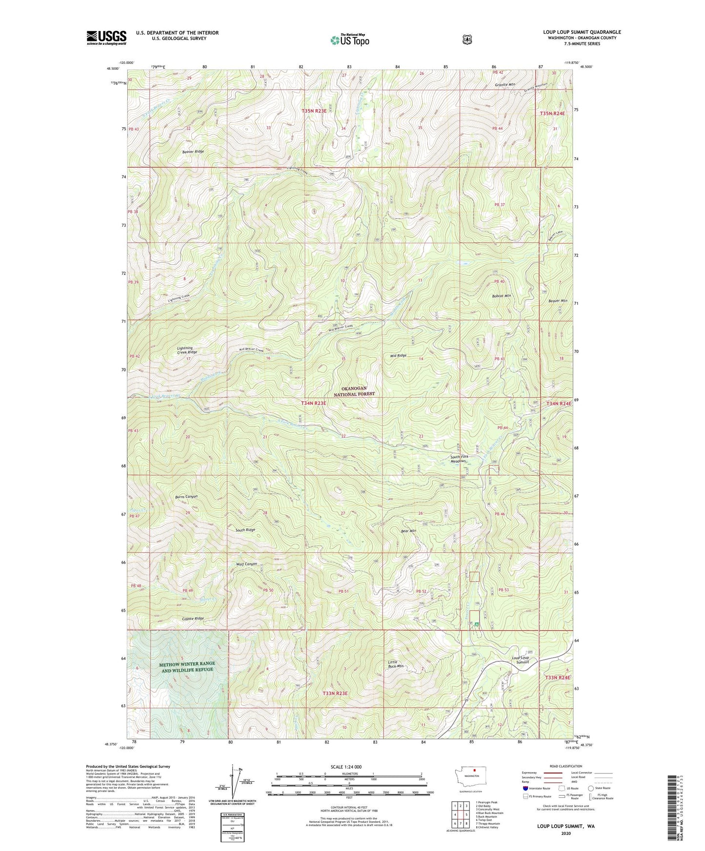
Loup Loup Summit Washington US Topo Map
Couldn't load pickup availability
Also explore the Loup Loup Summit Forest Service Topo of this same quad for updated USFS data
2023 topographic map quadrangle Loup Loup Summit in the state of Washington. Scale: 1:24000. Based on the newly updated USGS 7.5' US Topo map series, this map is in the following counties: Okanogan. The map contains contour data, water features, and other items you are used to seeing on USGS maps, but also has updated roads and other features. This is the next generation of topographic maps. Printed on high-quality waterproof paper with UV fade-resistant inks.
Quads adjacent to this one:
West: Blue Buck Mountain
Northwest: Pearrygin Peak
North: Old Baldy
Northeast: Conconully West
East: Buck Mountain
Southeast: Chiliwist Valley
South: Thrapp Mountain
Southwest: Twisp East
This map covers the same area as the classic USGS quad with code o48119d8.
Contains the following named places: Bear Mountain, Bobcat Mountain, Coyote Ridge, Granite Mountain, Hidden Camp, J R Picnic Area, Leighty Camp, Lightning Creek, Lightning Creek Ridge, Little Buck Mountain, Loup Loup Campground, Loup Loup Recreation Area, Loup Loup Ski Area, Loup Loup Summit, Methow Winter Range and Wildlife Refuge, Middle Fork, Middle Ridge, South Fork Meadows, South Ridge, South Summit