MyTopo
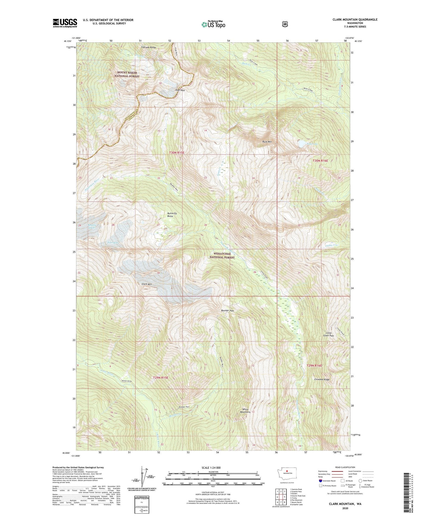
Clark Mountain Washington US Topo Map
Couldn't load pickup availability
Also explore the Clark Mountain Forest Service Topo of this same quad for updated USFS data
2023 topographic map quadrangle Clark Mountain in the state of Washington. Scale: 1:24000. Based on the newly updated USGS 7.5' US Topo map series, this map is in the following counties: Chelan, Snohomish. The map contains contour data, water features, and other items you are used to seeing on USGS maps, but also has updated roads and other features. This is the next generation of topographic maps. Printed on high-quality waterproof paper with UV fade-resistant inks.
Quads adjacent to this one:
West: Glacier Peak East
Northwest: Gamma Peak
North: Suiattle Pass
Northeast: Holden
East: Trinity
Southeast: Schaefer Lake
South: Mount David
Southwest: Poe Mountain
This map covers the same area as the classic USGS quad with code o48120a8.
Contains the following named places: Boulder Creek, Boulder Pass, Buck Creek, Buck Mountain, Butterfly Butte, Butterfly Glacier, Chiwawa Ridge, Clark Glacier, Clark Mountain, High Pass, King Lake, Little Giant Pass, Louis Creek, Pilz Glacier, Richardson Glacier, White Mountains