MyTopo
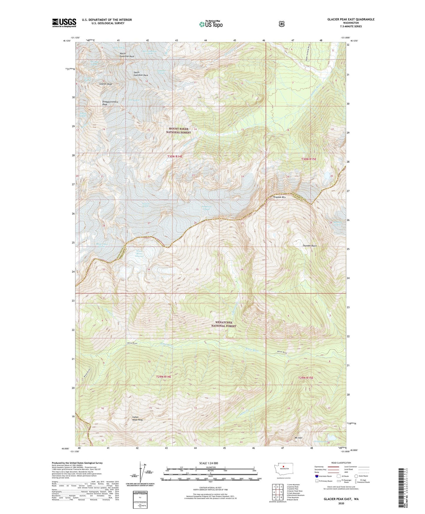
Glacier Peak East Washington US Topo Map
Couldn't load pickup availability
Also explore the Glacier Peak East Forest Service Topo of this same quad for updated USFS data
2023 topographic map quadrangle Glacier Peak East in the state of Washington. Scale: 1:24000. Based on the newly updated USGS 7.5' US Topo map series, this map is in the following counties: Snohomish, Chelan. The map contains contour data, water features, and other items you are used to seeing on USGS maps, but also has updated roads and other features. This is the next generation of topographic maps. Printed on high-quality waterproof paper with UV fade-resistant inks.
Quads adjacent to this one:
West: Glacier Peak West
Northwest: Lime Mountain
North: Gamma Peak
Northeast: Suiattle Pass
East: Clark Mountain
Southeast: Mount David
South: Poe Mountain
Southwest: Benchmark Mountain
This map covers the same area as the classic USGS quad with code o48121a1.
Contains the following named places: Airplane Lake, Amber Creek, Chocolate Glacier, Cool Glacier, Disappointment Peak, Foam Creek, Glacier Peak, Honeycomb Glacier, Indian Head Peak, Kennedy Glacier, Lightning Creek, Mount Saul, North Guardian Glacier, North Guardian Rock, South Guardian Rock, Suiattle Glacier, Tenpeak Mountain, Thunder Basin, Thunder Creek, White Chuck Glacier, White River Glacier