MyTopo
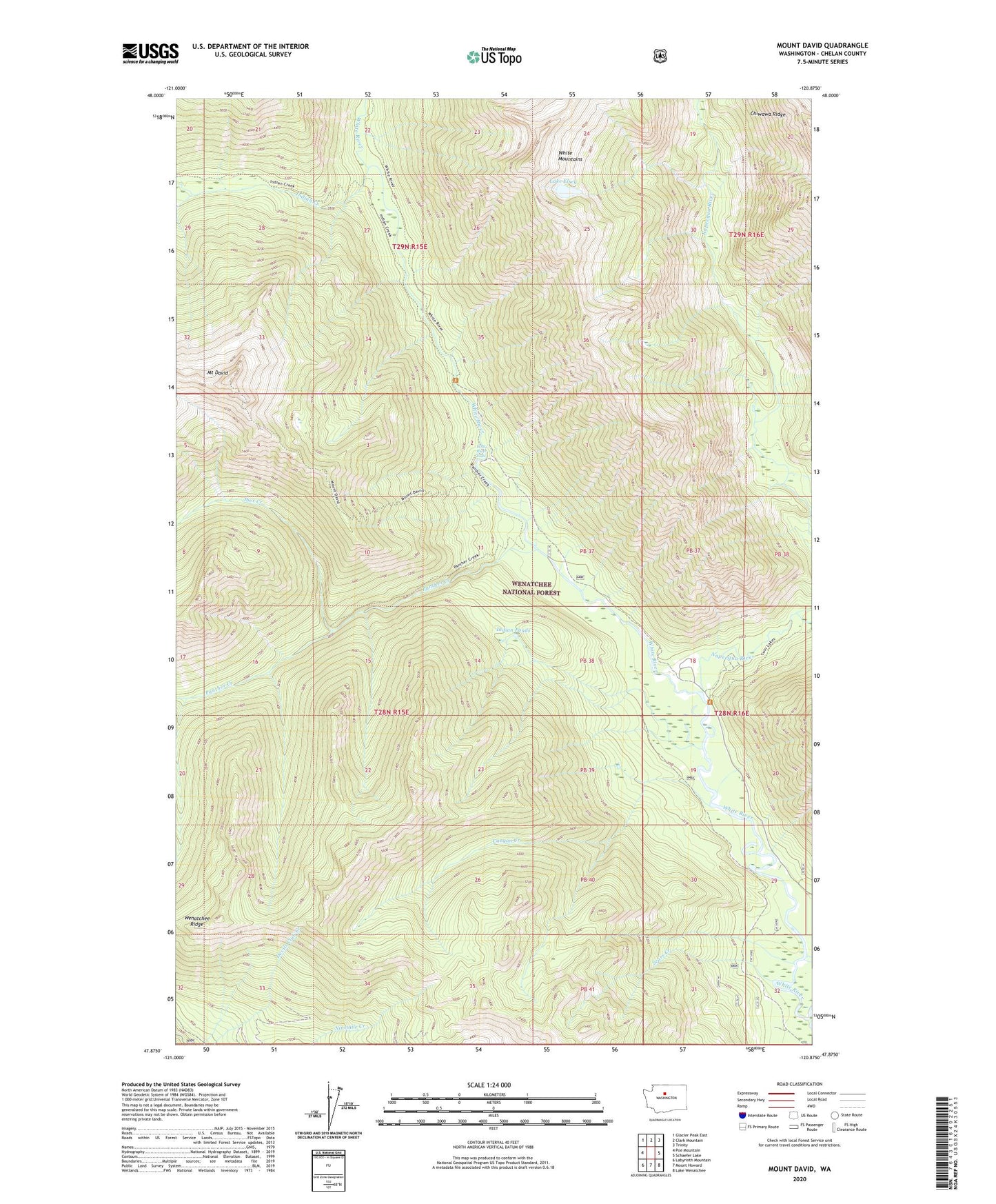
Mount David Washington US Topo Map
Couldn't load pickup availability
Also explore the Mount David Forest Service Topo of this same quad for updated USFS data
2023 topographic map quadrangle Mount David in the state of Washington. Scale: 1:24000. Based on the newly updated USGS 7.5' US Topo map series, this map is in the following counties: Chelan. The map contains contour data, water features, and other items you are used to seeing on USGS maps, but also has updated roads and other features. This is the next generation of topographic maps. Printed on high-quality waterproof paper with UV fade-resistant inks.
Quads adjacent to this one:
West: Poe Mountain
Northwest: Glacier Peak East
North: Clark Mountain
Northeast: Trinity
East: Schaefer Lake
Southeast: Lake Wenatchee
South: Mount Howard
Southwest: Labyrinth Mountain
This map covers the same area as the classic USGS quad with code o47120h8.
Contains the following named places: Canyon Creek, Grasshopper Meadows Campground, Ibex Creek, Indian Creek, Indian Ponds, Lake Elsey, Mount David, Napeequa Crossing Campground, Napeequa River, Panther Creek, Sears Creek, Tall Timber Ranch, Twin Lakes Creek, White River Falls, White River Falls Campground