MyTopo
Clayton Washington US Topo Map
Couldn't load pickup availability
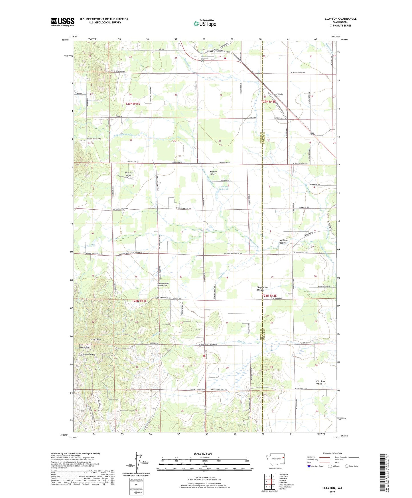
2020 topographic map quadrangle Clayton in the state of Washington. Scale: 1:24000. Based on the newly updated USGS 7.5' US Topo map series, this map is in the following counties: Stevens, Spokane. The map contains contour data, water features, and other items you are used to seeing on USGS maps, but also has updated roads and other features. This is the next generation of topographic maps. Printed on high-quality waterproof paper with UV fade-resistant inks.
Quads adjacent to this one:
West: Tumtum
Northwest: Springdale
North: Deer Lake
Northeast: Fan Lake
East: Deer Park
Southeast: Dartford
South: Nine Mile Falls
Southwest: Four Mound Prairie
Contains the following named places: Beaver Creek, Big Foot Valley, Burroughs School, Christiansons, Clayton, Clayton Community Bible Church, Clayton Meadows Mobile Home Park, Clayton Post Office, Cross Winds Airport, Deer Flat Airport, Dunns Mountain, Fielding Airport, Frog Creek, Hazard, Keystone Corners, Lenhard Reservoir, Lenhard Reservoir Dam, North Vista Mobile Home Park, Spring Creek, Stevens County Fire District 1 Station 1 Clayton, Stevens County Fire District 1 Station 3 - Twin Mountain, Twin Mountain Fire Station, Twin Mountains, Wild Rose Prairie, Williams Valley, Williams Valley Hillside Cemetery, ZIP Code: 99006