MyTopo
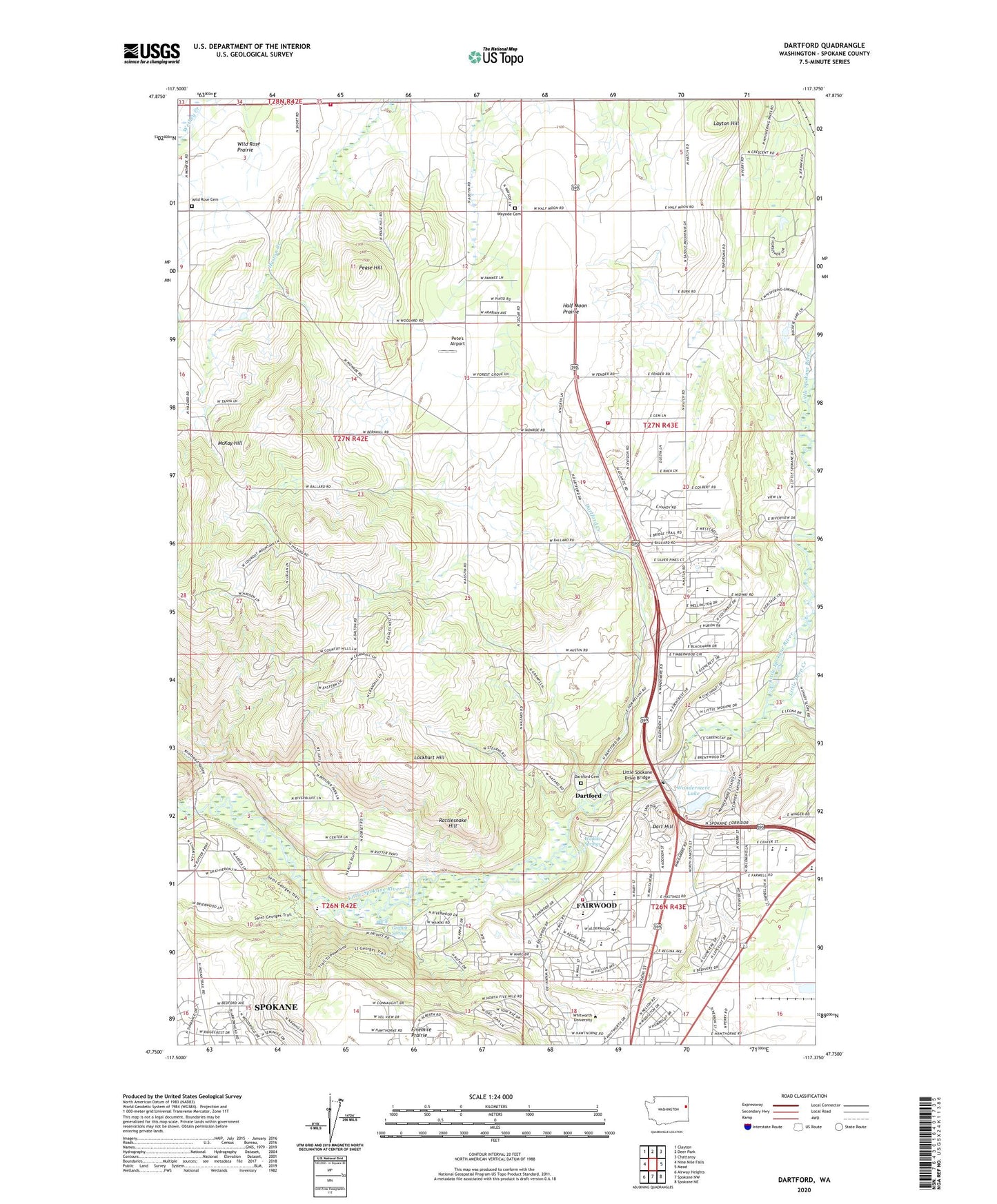
Dartford Washington US Topo Map
Couldn't load pickup availability
2023 topographic map quadrangle Dartford in the state of Washington. Scale: 1:24000. Based on the newly updated USGS 7.5' US Topo map series, this map is in the following counties: Spokane. The map contains contour data, water features, and other items you are used to seeing on USGS maps, but also has updated roads and other features. This is the next generation of topographic maps. Printed on high-quality waterproof paper with UV fade-resistant inks.
Quads adjacent to this one:
West: Nine Mile Falls
Northwest: Clayton
North: Deer Park
Northeast: Chattaroy
East: Mead
Southeast: Spokane NE
South: Spokane NW
Southwest: Airway Heights
This map covers the same area as the classic USGS quad with code o47117g4.
Contains the following named places: Brentwood Elementary School, Commellini Junction, Dart Hill, Dartford, Dartford Cemetery, Dartford Creek, Deadman Creek, Fairwood, Fairwood Census Designated Place, Fairwood Shopping Center, Farwell Elementary School, Griffith Spring, Half Moon Prairie, Hamann Corner, KWRS-FM (Spokane), Layton Hill, Little Deep Creek, Little Spokane Drive Bridge, Lockhart Hill, McKay Hill, Mead Senior High School, Midway Elementary School, Northwood Middle School, Pease Hill, Pete's Airport, Pine River Park, Rattlesnake Hill, Saint George's School, Spokane Country Club, Spokane County Fire District 4 Station 45 Wild Rose, Spokane County Fire District 4 Station 49 Wayside, Spokane County Fire District 9 Station 91, Spokane State Fish Hatchery, Waikiki Springs, Wandermere Lake, Wandermere Lake Dam, Wayside, Wayside Cemetery, Whitworth University, Wild Rose, Wild Rose Cemetery, ZIP Codes: 99208, 99218