MyTopo
Four Mound Prairie Washington US Topo Map
Couldn't load pickup availability
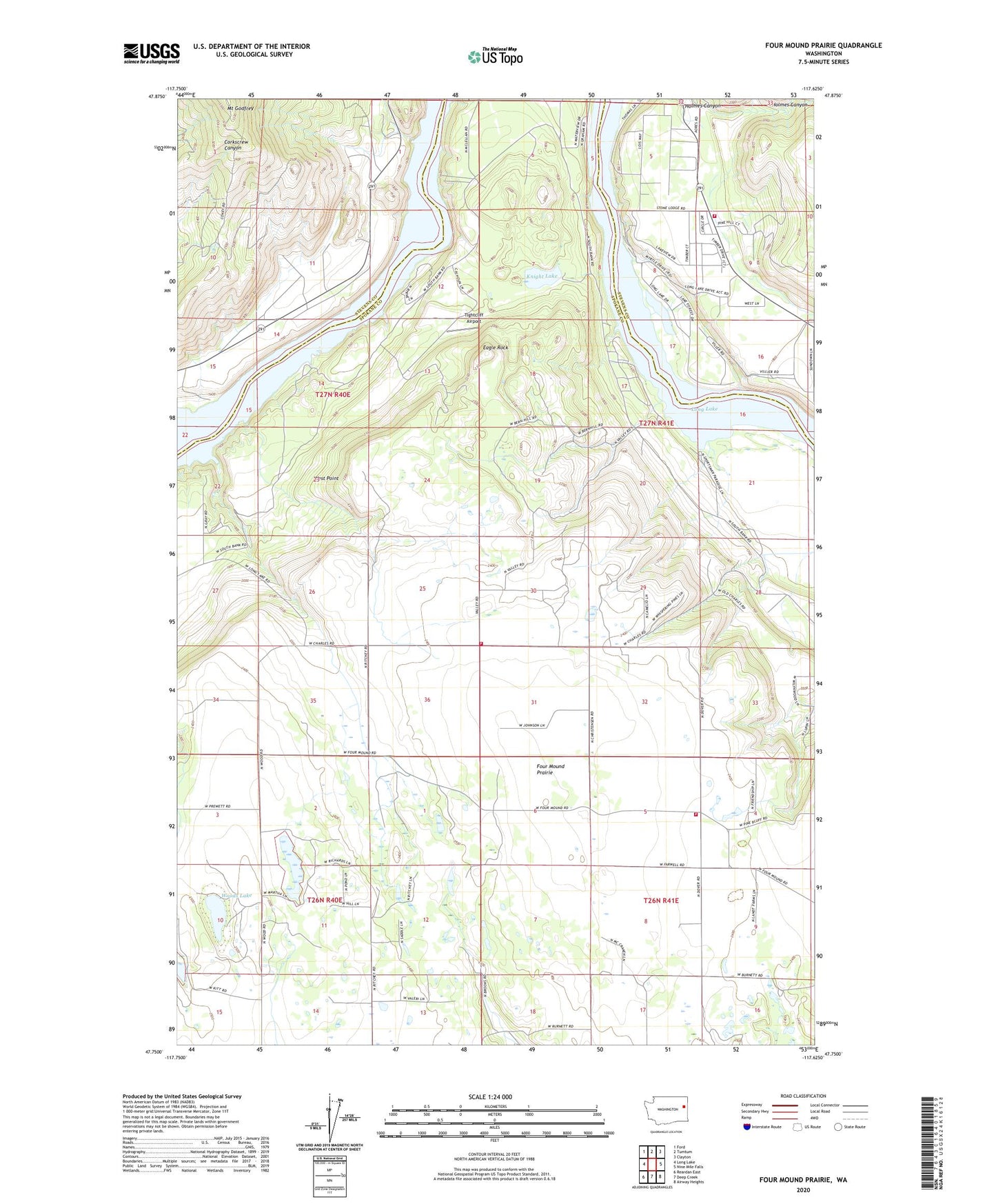
2023 topographic map quadrangle Four Mound Prairie in the state of Washington. Scale: 1:24000. Based on the newly updated USGS 7.5' US Topo map series, this map is in the following counties: Spokane, Stevens. The map contains contour data, water features, and other items you are used to seeing on USGS maps, but also has updated roads and other features. This is the next generation of topographic maps. Printed on high-quality waterproof paper with UV fade-resistant inks.
Quads adjacent to this one:
West: Long Lake
Northwest: Ford
North: Tumtum
Northeast: Clayton
East: Nine Mile Falls
Southeast: Airway Heights
South: Deep Creek
Southwest: Reardan East
This map covers the same area as the classic USGS quad with code o47117g6.
Contains the following named places: Central School, Davis Lake, Eagle Rock, Four Mound Fire Station, Four Mound Prairie, Knight Lake, Mount Godfrey, Spokane County Fire District 5 Station 51, Spokane County Fire District 5 Station 52, Stevens County Fire District 1 Fire Station 4 Tumtum, Tightcliff Airport, West Point, Woods Lake, ZIP Code: 99026