MyTopo
Tumtum Washington US Topo Map
Couldn't load pickup availability
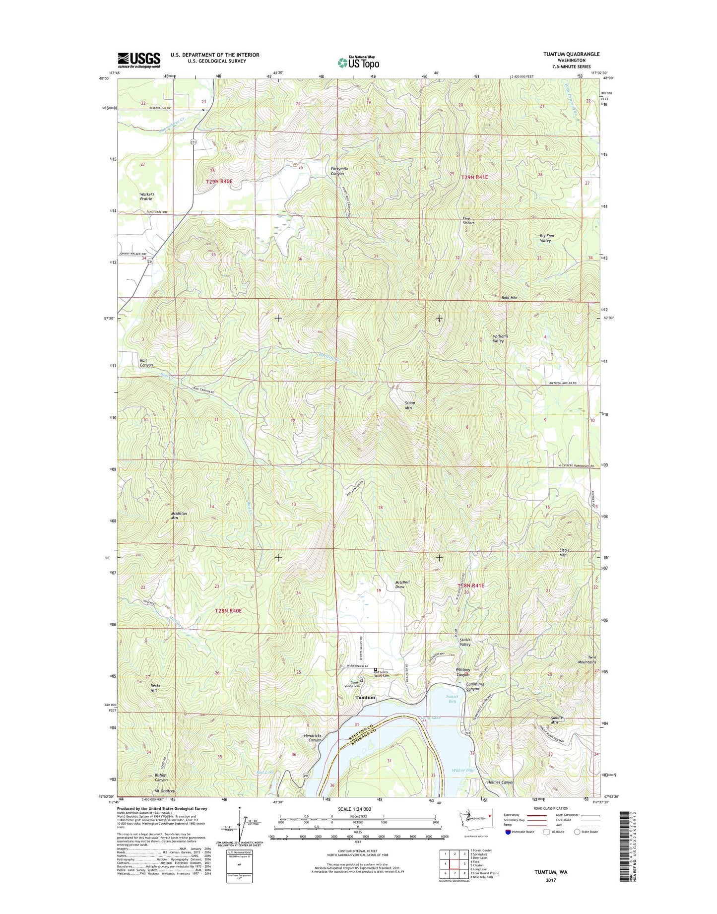
2023 topographic map quadrangle Tumtum in the state of Washington. Scale: 1:24000. Based on the newly updated USGS 7.5' US Topo map series, this map is in the following counties: Stevens, Spokane. The map contains contour data, water features, and other items you are used to seeing on USGS maps, but also has updated roads and other features. This is the next generation of topographic maps. Printed on high-quality waterproof paper with UV fade-resistant inks.
Quads adjacent to this one:
West: Ford
Northwest: Forest Center
North: Springdale
Northeast: Deer Lake
East: Clayton
Southeast: Nine Mile Falls
South: Four Mound Prairie
Southwest: Long Lake
This map covers the same area as the classic USGS quad with code o47117h6.
Contains the following named places: Bald Mountain, Bartlett Creek, Becks Hill, Cummings Canyon, Five Sisters, Fortymile Canyon, Hendricks Canyon, Holmes Canyon, Little Mountain, Loon Lake Division, McMillan Mountain, Mitchell Draw, Old Scotts Valley Cemetery, Rail Canyon, Red Lake, Saddle Mountain, Scoop Mountain, Scotts Valley, Scotts Valley Cemetery, Stony Peak, Sunset Bay, Tumtum, Whitney Canyon, Willow Bay