MyTopo
Deer Park Washington US Topo Map
Couldn't load pickup availability
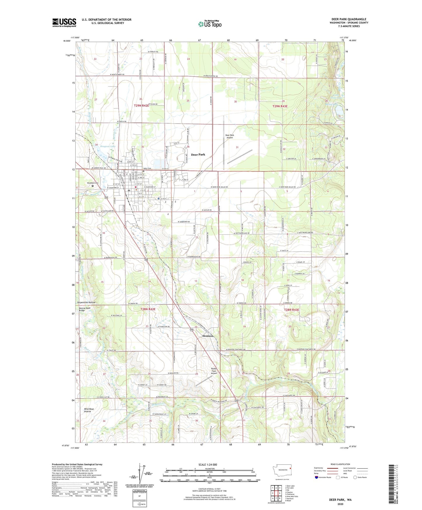
2023 topographic map quadrangle Deer Park in the state of Washington. Scale: 1:24000. Based on the newly updated USGS 7.5' US Topo map series, this map is in the following counties: Spokane. The map contains contour data, water features, and other items you are used to seeing on USGS maps, but also has updated roads and other features. This is the next generation of topographic maps. Printed on high-quality waterproof paper with UV fade-resistant inks.
Quads adjacent to this one:
West: Clayton
Northwest: Deer Lake
North: Fan Lake
Northeast: Elk
East: Chattaroy
Southeast: Mead
South: Dartford
Southwest: Nine Mile Falls
This map covers the same area as the classic USGS quad with code o47117h4.
Contains the following named places: Arcadia Elementary School, Arcadia Park, Assembly of God Tri - County Christian Center, Bailey Lake, Christ Church of Deer Park, City of Deer Park, Deer Park, Deer Park Airport, Deer Park Ambulance, Deer Park Church of Nazarene, Deer Park Division, Deer Park Elementary School, Deer Park First Baptist Church, Deer Park Health Center and Hospital, Deer Park High School, Deer Park Post Office, Deer Park United Methodist Church, Denison, Dragoon Creek State Park, Dragoon Lake, Dragoon Lake Dam, Ecks Creek, Faith Lutheran Church, Flying Firemen Facility, Grace Evangelical Free Church, Hite Park, Huston Creek, KAZZ-FM (Deer Park), Kelly Cemetery, Kingdom Hall of Jehovahs Witnesses, Little Trout Lake, Monroe Road Bridge, Mud Creek, Open Door Congregational Church, Perrins Field, Radial Flyer Airport, Saint Mary's Church, Spokane County Fire District 4 Station 41 Deer Park, Spokane State Game Farm, T Bridge Corner, Tri-County Fairgrounds, Turpentine Hollow, West Branch Dragoon Creek, Wethey Creek, Woodland Cemetery, Zion Lutheran Church