MyTopo
Nine Mile Falls Washington US Topo Map
Couldn't load pickup availability
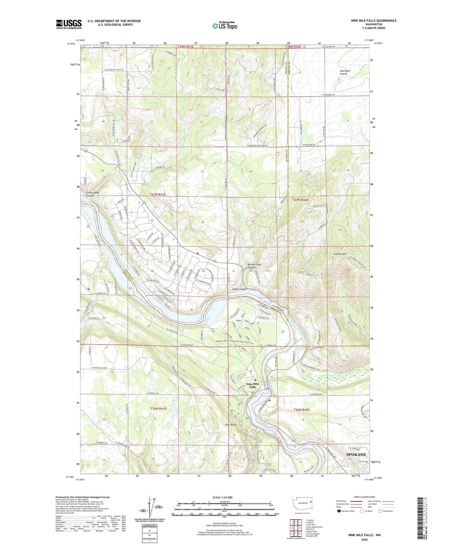
2023 topographic map quadrangle Nine Mile Falls in the state of Washington. Scale: 1:24000. Based on the newly updated USGS 7.5' US Topo map series, this map is in the following counties: Spokane, Stevens. The map contains contour data, water features, and other items you are used to seeing on USGS maps, but also has updated roads and other features. This is the next generation of topographic maps. Printed on high-quality waterproof paper with UV fade-resistant inks.
Quads adjacent to this one:
West: Four Mound Prairie
Northwest: Tumtum
North: Clayton
Northeast: Deer Park
East: Dartford
Southeast: Spokane NW
South: Airway Heights
Southwest: Deep Creek
This map covers the same area as the classic USGS quad with code o47117g5.
Contains the following named places: Aubrey L White Park, Barney Coker Canyon, Coulee Creek, Deep Creek, Fort Spokane Historic Site, Indian Rock Paintings, Indian Rock Paintings State Park, Lake Spokane Elementary School, Lakeside High School, Little Sandy Canyon, Little Spokane River, Little Spokane River Park, Lookout Mountain, Nine Mile Dam, Nine Mile Falls, Nine Mile Falls Elementary School, Nine Mile Falls Post Office, Nine Mile Reservoir, Pine Bluff, Sandy Canyon, Spokane County Fire District 9 Station 93, Spokane County Fire District 9 Station 97, Spokane House Historic Site, Stevens County Fire District 1 Station 8 - Suncrest, Suncrest, Suncrest Census Designated Place