MyTopo
Conconully West Washington US Topo Map
Couldn't load pickup availability
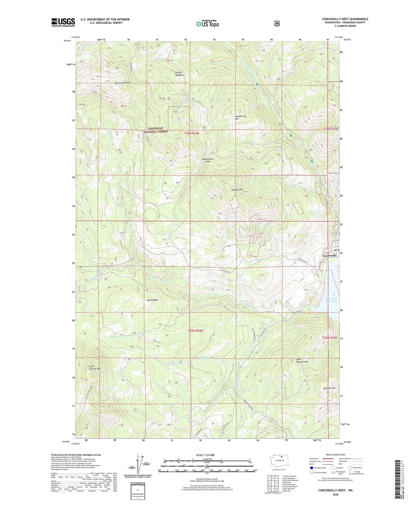
2020 topographic map quadrangle Conconully West in the state of Washington. Scale: 1:24000. Based on the newly updated USGS 7.5' US Topo map series, this map is in the following counties: Okanogan. The map contains contour data, water features, and other items you are used to seeing on USGS maps, but also has updated roads and other features. This is the next generation of topographic maps. Printed on high-quality waterproof paper with UV fade-resistant inks.
Quads adjacent to this one:
West: Old Baldy
Northwest: Tiffany Mountain
North: Coxit Mountain
Northeast: Blue Goat Mountain
East: Conconully East
Southeast: Ruby Hill
South: Buck Mountain
Southwest: Loup Loup Summit
Contains the following named places: Alder Campground, Buckhorn Creek, Cedar Creek, Center Creek, Conconully Information Station, Conconully Post Office, Conconully Reservoir, Conconully State Park, Conger Creek, Cottonwood Campground, Dunn Creek, First Creek, Funk Mountain Trail, Granite Creek, Granite Trail, Gubser Mine, Johnny Boy Mine, Kerr Campground, Little Granite Mountain, Little Peacock Mountain, McCay Creek, Meyer Ranch, Mineral Hill, Muckamuck Creek, Muckamuck Hill, Muckamuck Mountain, Muckamuck Pass, Oriole Campground, Peacock Meadows, Peacock Mountain, Ray Cabin, Ray Creek, Ray Trail, Reed Ranch, Reed Ridge, Rusty Creek, Salmon Falls, Scheiner Creek, Sophys Meadows, South Fork Salmon Creek, Sunny Peak Mine, Town of Conconully, Tunnel Trail, West Fork Salmon Creek, Wheeler Mine, ZIP Code: 98819