MyTopo
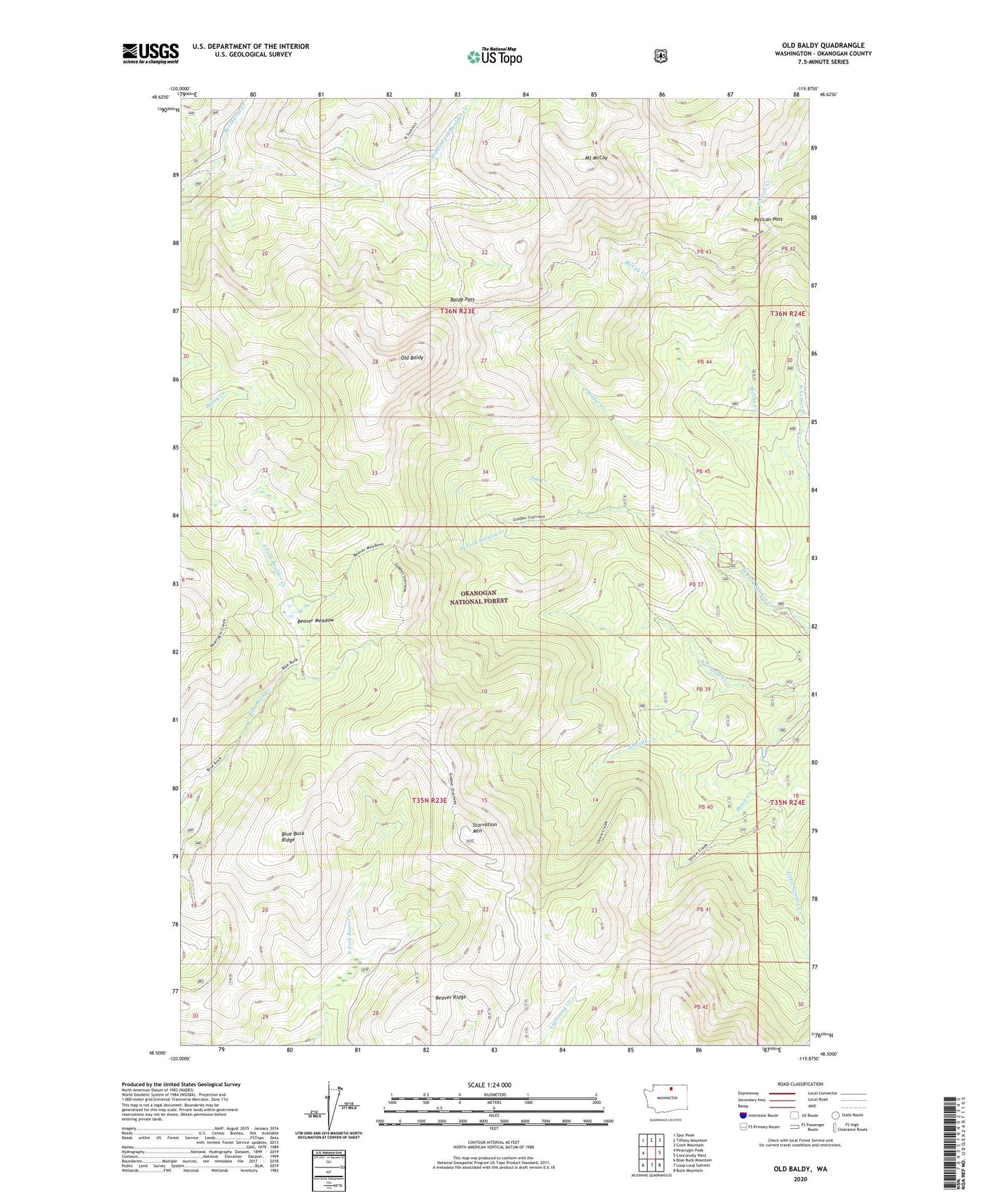
Old Baldy Washington US Topo Map
Couldn't load pickup availability
Also explore the Old Baldy Forest Service Topo of this same quad for updated USFS data
2023 topographic map quadrangle Old Baldy in the state of Washington. Scale: 1:24000. Based on the newly updated USGS 7.5' US Topo map series, this map is in the following counties: Okanogan. The map contains contour data, water features, and other items you are used to seeing on USGS maps, but also has updated roads and other features. This is the next generation of topographic maps. Printed on high-quality waterproof paper with UV fade-resistant inks.
Quads adjacent to this one:
West: Pearrygin Peak
Northwest: Spur Peak
North: Tiffany Mountain
Northeast: Coxit Mountain
East: Conconully West
Southeast: Buck Mountain
South: Loup Loup Summit
Southwest: Blue Buck Mountain
This map covers the same area as the classic USGS quad with code o48119e8.
Contains the following named places: Baldy Pass, Beaver Meadow, Beaver Ridge, Bernhardt Creek, Blue Buck Ridge, Blue Buck Trail, Cathedral Driveway, Golden Stairway Trail, Jim Creek, Little Granite Creek, McCay Trail, Mount McCay, North Granite Creek, Old Baldy, Pearrygin Trail, Pelican Pass, Pretty Bird Trail, Ryan Cabin, Shrew Creek, Shrew Creek Trail, South Fork Trail, Starvation Mountain, Wagon Camp, Wilder Creek