MyTopo
Copper Butte Washington US Topo Map
Couldn't load pickup availability
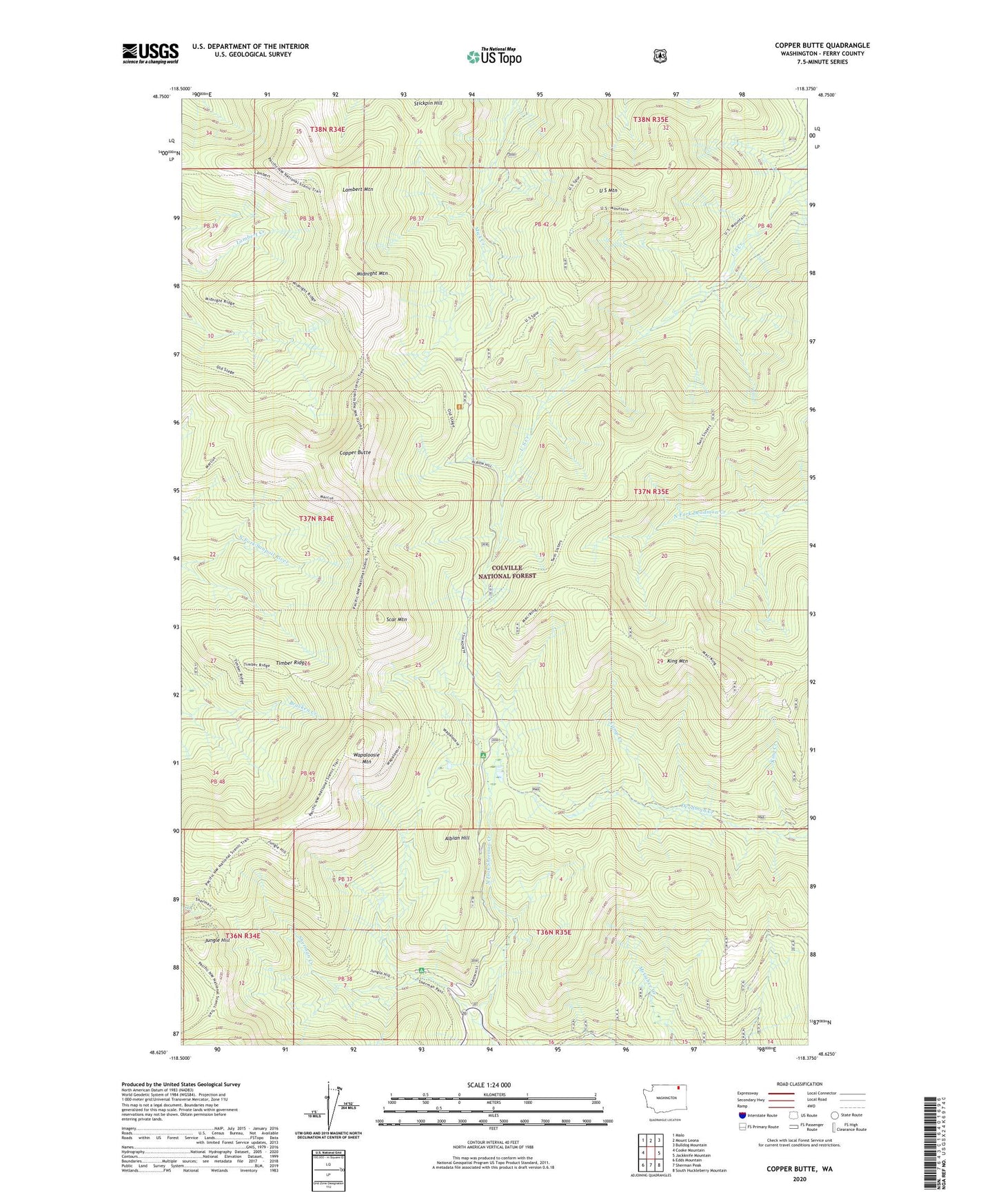
2020 topographic map quadrangle Copper Butte in the state of Washington. Scale: 1:24000. Based on the newly updated USGS 7.5' US Topo map series, this map is in the following counties: Ferry. The map contains contour data, water features, and other items you are used to seeing on USGS maps, but also has updated roads and other features. This is the next generation of topographic maps. Printed on high-quality waterproof paper with UV fade-resistant inks.
Quads adjacent to this one:
West: Cooke Mountain
Northwest: Malo
North: Mount Leona
Northeast: Bulldog Mountain
East: Jackknife Mountain
Southeast: South Huckleberry Mountain
South: Sherman Peak
Southwest: Edds Mountain
Contains the following named places: Albian Hill, Camp Creek, Copper Butte, Jungle Hill, King Creek, King Mountain, Lambert Mountain, Midnight Mountain, North Fork Sherman Creek, Scar Mountain, Stickpin Hill, Timber Ridge, U S Mountain, Wapaloosie Mountain