MyTopo
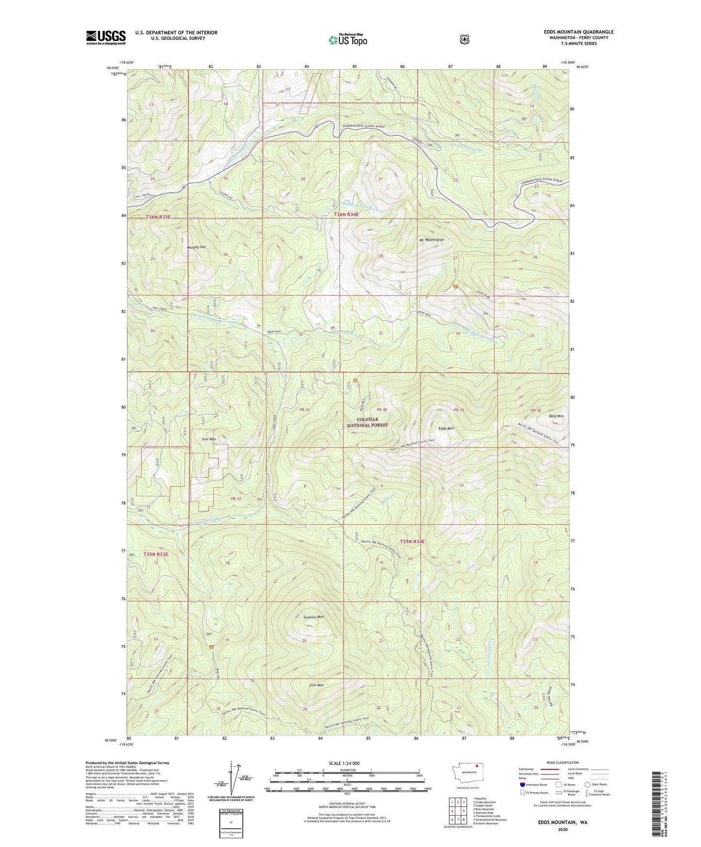
Edds Mountain Washington US Topo Map
Couldn't load pickup availability
Also explore the Edds Mountain Forest Service Topo of this same quad for updated USFS data
2023 topographic map quadrangle Edds Mountain in the state of Washington. Scale: 1:24000. Based on the newly updated USGS 7.5' US Topo map series, this map is in the following counties: Ferry. The map contains contour data, water features, and other items you are used to seeing on USGS maps, but also has updated roads and other features. This is the next generation of topographic maps. Printed on high-quality waterproof paper with UV fade-resistant inks.
Quads adjacent to this one:
West: Bear Mountain
Northwest: Republic
North: Cooke Mountain
Northeast: Copper Butte
East: Sherman Peak
Southeast: Sitdown Mountain
South: Seventeenmile Mountain
Southwest: Thirteenmile Creek
This map covers the same area as the classic USGS quad with code o48118e5.
Contains the following named places: Bald Mountain, California Mine, Edds Mountain, Fire Mountain, Granite Mountain, Iron Mountain, Middle Fork O'Brien Creek, Mount Washington, Murphy Hill, Shovel Creek