MyTopo
Hunger Mountain Washington US Topo Map
Couldn't load pickup availability
Also explore the Hunger Mountain Forest Service Topo of this same quad for updated USFS data
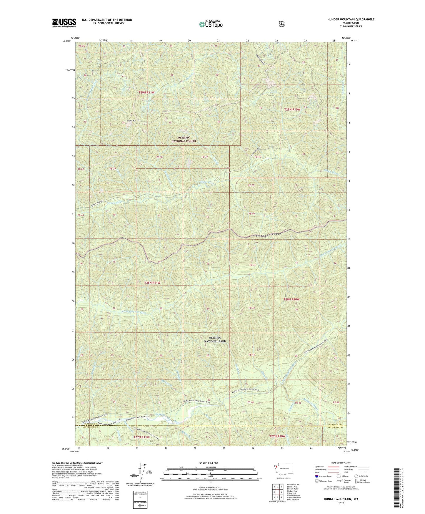
2023 topographic map quadrangle Hunger Mountain in the state of Washington. Scale: 1:24000. Based on the newly updated USGS 7.5' US Topo map series, this map is in the following counties: Clallam, Jefferson. The map contains contour data, water features, and other items you are used to seeing on USGS maps, but also has updated roads and other features. This is the next generation of topographic maps. Printed on high-quality waterproof paper with UV fade-resistant inks.
Quads adjacent to this one:
West: Indian Pass
Northwest: Deadmans Hill
North: Snider Peak
Northeast: Mount Muller
East: Slide Peak
Southeast: Owl Mountain
South: Spruce Mountain
Southwest: Winfield Creek
This map covers the same area as the classic USGS quad with code o47124h1.
Contains the following named places: All-In Creek, Bee Creek, Brandeberry Creek, Brush Creek, Elbow Creek, Fifteenmile Shelter, Flapjack Shelter, Fraker Creek, Hunger Mountain, Lotloh Creek, Mineral Creek, North Fork Bogachiel River, Pete Creek, Rugged Ridge, Spruce Creek, Sunday Creek, Tumwata Creek, Vast Creek, Warkum Creek