
MyTopo
Deep Creek Washington US Topo Map
Couldn't load pickup availability
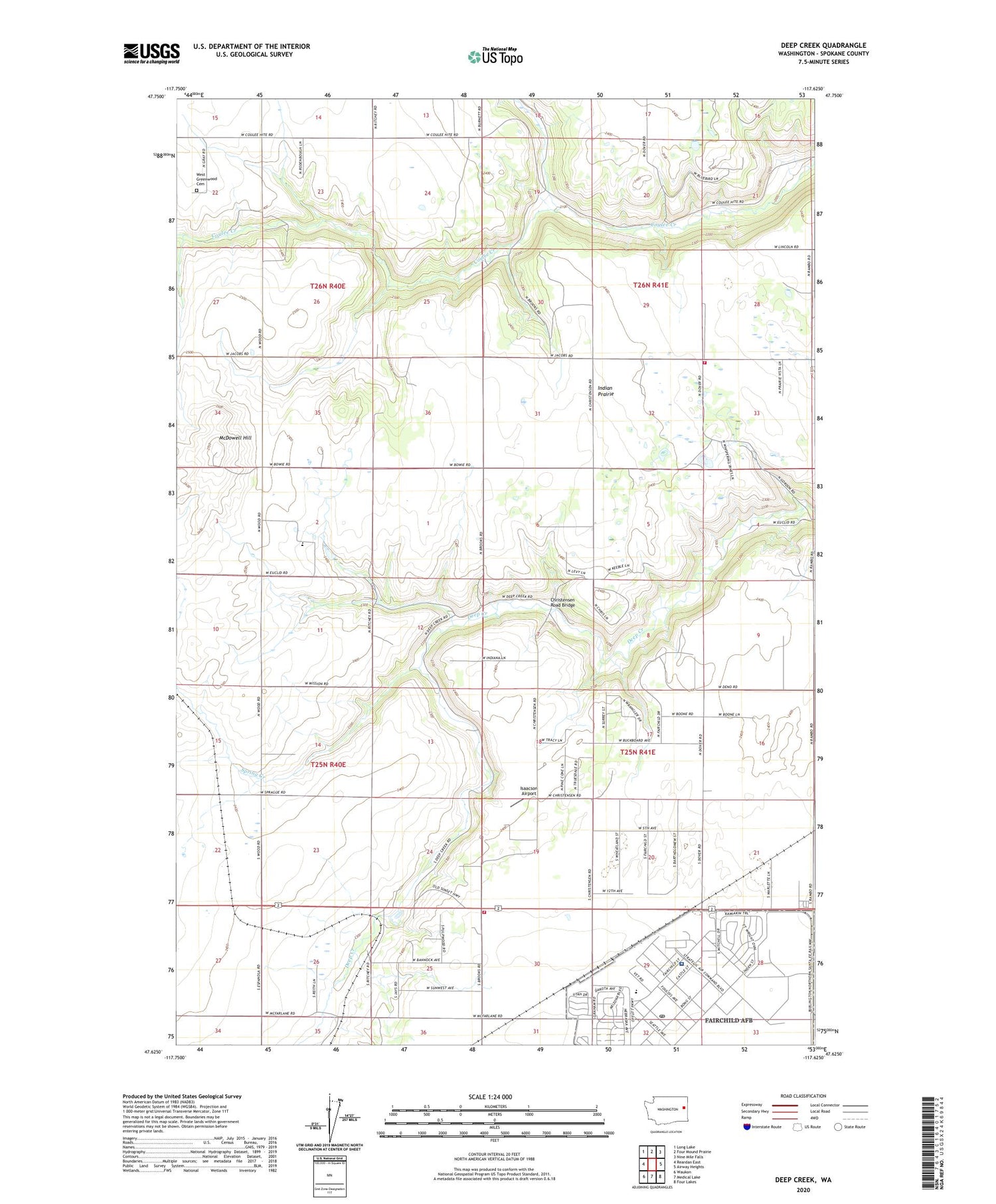
2020 topographic map quadrangle Deep Creek in the state of Washington. Scale: 1:24000. Based on the newly updated USGS 7.5' US Topo map series, this map is in the following counties: Spokane. The map contains contour data, water features, and other items you are used to seeing on USGS maps, but also has updated roads and other features. This is the next generation of topographic maps. Printed on high-quality waterproof paper with UV fade-resistant inks.
Quads adjacent to this one:
West: Reardan East
Northwest: Long Lake
North: Four Mound Prairie
Northeast: Nine Mile Falls
East: Airway Heights
Southeast: Four Lakes
South: Medical Lake
Southwest: Waukon
Contains the following named places: Airway Heights Division, Blair Elementary School, Botteen School, Camp Washington, Christensen Road Bridge, Deep Creek, Deep Creek Hutterian School, Fairchild, Fairchild Air Force Base Post Office, Galena, Historical Monument, Indian Prairie, Indian Prairie School, Isaacson Airport, McDowell Hill, Miller Park, Spokane Battlefield State Park, Spokane County Fire District 10 Station 3, Spokane County Fire District 10 Station 4, Spokane Plains Battlefield, Spring Creek, United States Air Force Hospital, West Greenwood Cemetery


