MyTopo
Airway Heights Washington US Topo Map
Couldn't load pickup availability
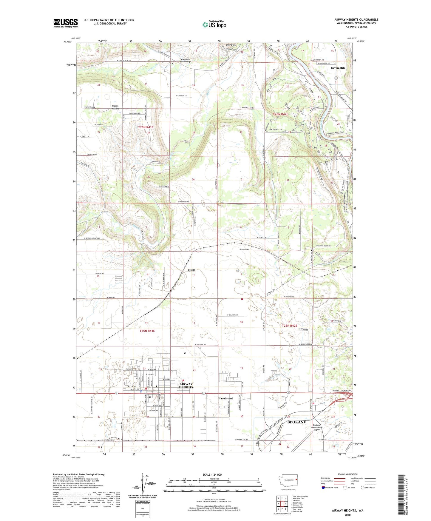
2023 topographic map quadrangle Airway Heights in the state of Washington. Scale: 1:24000. Based on the newly updated USGS 7.5' US Topo map series, this map is in the following counties: Spokane. The map contains contour data, water features, and other items you are used to seeing on USGS maps, but also has updated roads and other features. This is the next generation of topographic maps. Printed on high-quality waterproof paper with UV fade-resistant inks.
Quads adjacent to this one:
West: Deep Creek
Northwest: Four Mound Prairie
North: Nine Mile Falls
Northeast: Dartford
East: Spokane NW
Southeast: Spokane SW
South: Four Lakes
Southwest: Medical Lake
This map covers the same area as the classic USGS quad with code o47117f5.
Contains the following named places: Airway Heights, Airway Heights Corrections Center, Airway Heights Fire Department, Airway Heights Police Department, Airway Heights Post Office, Camp Seven Mile, City of Airway Heights, Countryside Seventh-day Adventist Elementary School, Deno School, Great Northern Elementary School, Hazelwood, Highland, KVXO-FM (Spokane), Lyons, Riverside State Park, Seven Mile, Seven Mile Road Bridge, Spokane County Fire District 10 Station 1, Spokane County Fire District 10 Station 5, Spokane International Airport Fire Department, Stevens Township Hall, Sun Dance Golf Course, Sunset Elementary School, Warsaw School, ZIP Codes: 99001, 99224