MyTopo
Deep Lake Washington US Topo Map
Couldn't load pickup availability
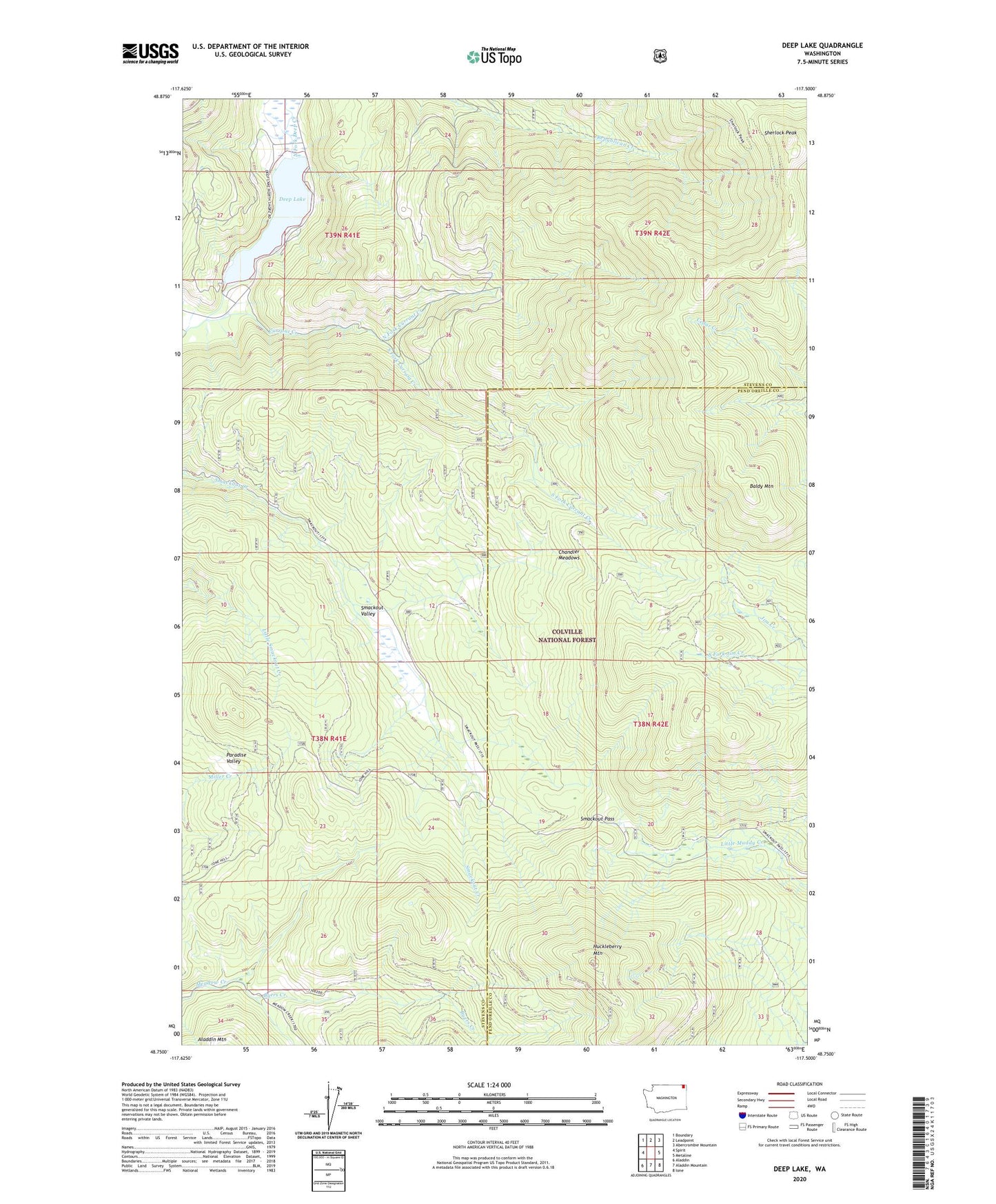
2020 topographic map quadrangle Deep Lake in the state of Washington. Scale: 1:24000. Based on the newly updated USGS 7.5' US Topo map series, this map is in the following counties: Stevens, Pend Oreille. The map contains contour data, water features, and other items you are used to seeing on USGS maps, but also has updated roads and other features. This is the next generation of topographic maps. Printed on high-quality waterproof paper with UV fade-resistant inks.
Quads adjacent to this one:
West: Spirit
Northwest: Boundary
North: Leadpoint
Northeast: Abercrombie Mountain
East: Metaline
Southeast: Ione
South: Aladdin Mountain
Southwest: Aladdin
Contains the following named places: Baldy Mountain, Bechtol Mine, Byers Creek, Chandler Meadows, Currant Creek, Deep Lake, Divine Place, Farmer Mine, Huckleberry Mountain, Jim Creek Mine, Maki Mine, North Fork Currant Creek, Paff Clearing, Paradise Valley, Peterson Clearing, Peterson Trail, Sherlock Peak, Smackout Camp, Smackout Pass, Smackout Valley, South Fork Currant Creek, Speller Camp, Thompson Iron Mine, Tyee Mine, Utacan Mine