MyTopo
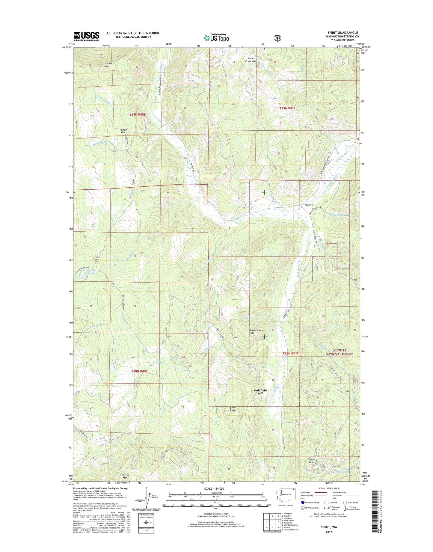
Spirit Washington US Topo Map
Couldn't load pickup availability
Also explore the Spirit Forest Service Topo of this same quad for updated USFS data
2023 topographic map quadrangle Spirit in the state of Washington. Scale: 1:24000. Based on the newly updated USGS 7.5' US Topo map series, this map is in the following counties: Stevens. The map contains contour data, water features, and other items you are used to seeing on USGS maps, but also has updated roads and other features. This is the next generation of topographic maps. Printed on high-quality waterproof paper with UV fade-resistant inks.
Quads adjacent to this one:
West: Onion Creek
Northwest: Northport
North: Boundary
Northeast: Leadpoint
East: Deep Lake
Southeast: Aladdin Mountain
South: Aladdin
Southwest: Gillette Mountain
This map covers the same area as the classic USGS quad with code o48117g6.
Contains the following named places: Black Rock Mine, Blue Ridge, Blue Ridge Mine, Copper King Mine, Deep Creek Mine, Frederickson Hill, Goldfield Mill, Great Western Mine, Harrier Creek, Ione Hill, Koski Hill, Last Chance Mine 3057, Lime Creek, Little Johnson Creek, Little Smackout Creek, Lookout Creek, Magma Mine, Marble Quarry, Martella Creek, Miller Creek, New England Mine, North Fork Deep Creek, Pick Creek, Quinns Meadows, Raisio Creek, Smackout Creek, South Fork Deep Creek, South Fork Grange, Spirit, Spirit School, Stevens County Fire District 10, Stonewall Mine, Todd Creek, Waymire Creek, West Fork Lime Creek