MyTopo
Deming Washington US Topo Map
Couldn't load pickup availability
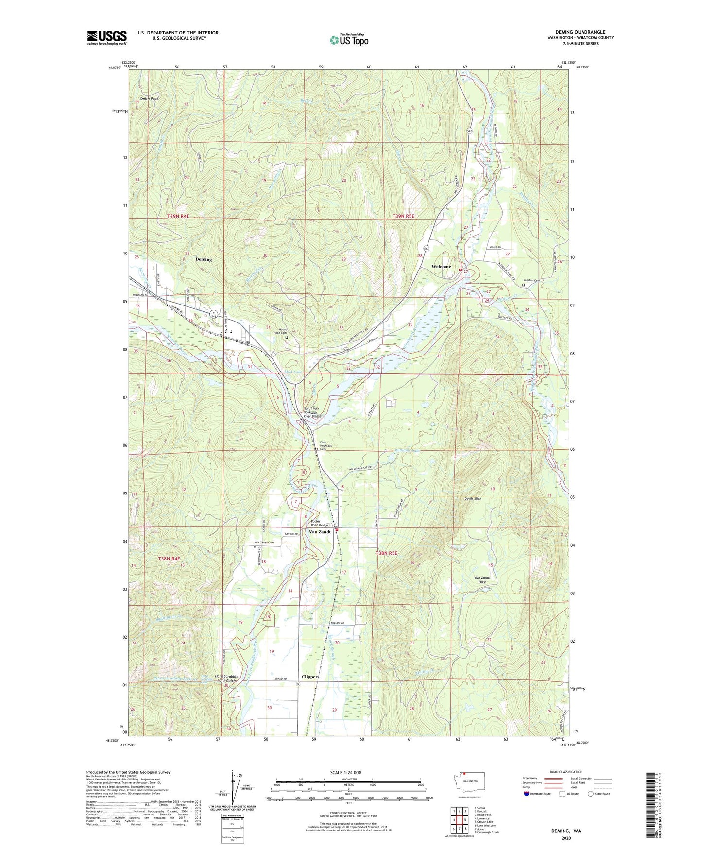
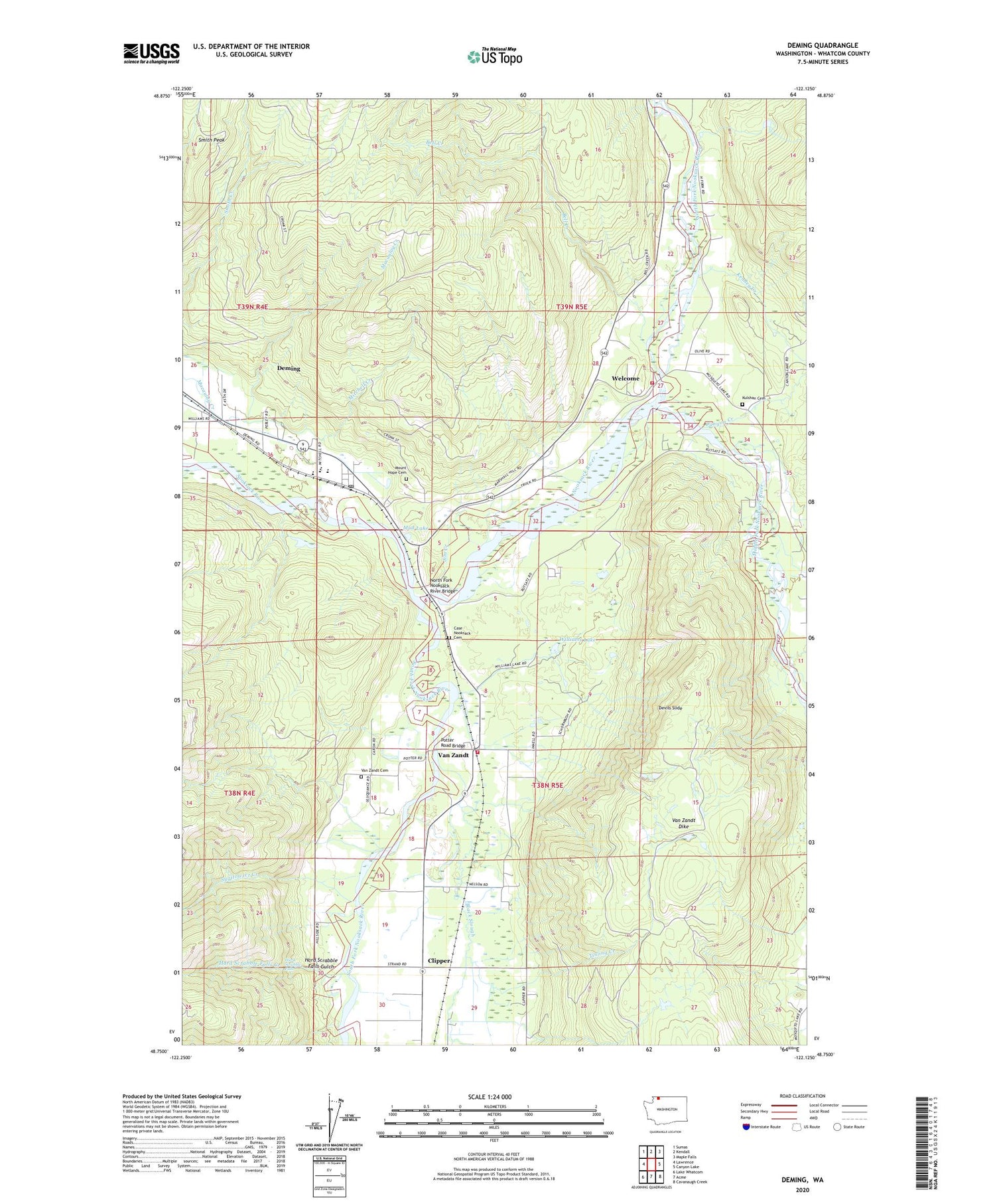
2020 topographic map quadrangle Deming in the state of Washington. Scale: 1:24000. Based on the newly updated USGS 7.5' US Topo map series, this map is in the following counties: Whatcom. The map contains contour data, water features, and other items you are used to seeing on USGS maps, but also has updated roads and other features. This is the next generation of topographic maps. Printed on high-quality waterproof paper with UV fade-resistant inks.
Quads adjacent to this one:
West: Lawrence
Northwest: Sumas
North: Kendall
Northeast: Maple Falls
East: Canyon Lake
Southeast: Cavanaugh Creek
South: Acme
Southwest: Lake Whatcom
Contains the following named places: Alpine Meadows Tree Farm, Bell Creek, Black Slough, Canyon Creek, Case, Case Nooksack Cemetery, Church of the Nazarene, Clipper, Deming, Deming Census Designated Place, Deming Elementary School, Deming Lookout Tower, Deming Post Office, Deming Presbyterian Church, Devils Slide, Hard Scrabble Falls, Hard Scrabble Falls Creek, Hard Scrabble Falls Gulch, Jim Creek, Kenney Creek, Kulshan, Kulshan Cemetery, Middle Fork Nooksack River, Mitchell Creek, Mount Baker High School, Mount Baker Junior High School, Mount Hope Cemetery, Mud Lake, North Fork Nooksack River, North Fork Nooksack River Bridge, Porter Creek, Potter Road Bridge, Rainey Farms, River of Life Community Church, Smith Peak, South Fork Nooksack River, Strachila Farm, Sygitowicz Creek, Tinling Creek, Van Zandt, Van Zandt Cemetery, Van Zandt Dike, Welcome, Welcome Grange Hall, Whatcom County Fire District 14 Station 93 Welcome, Whatcom County Fire District 16 Station 87, Williams Lake