MyTopo
Cavanaugh Creek Washington US Topo Map
Couldn't load pickup availability
Also explore the Cavanaugh Creek Forest Service Topo of this same quad for updated USFS data
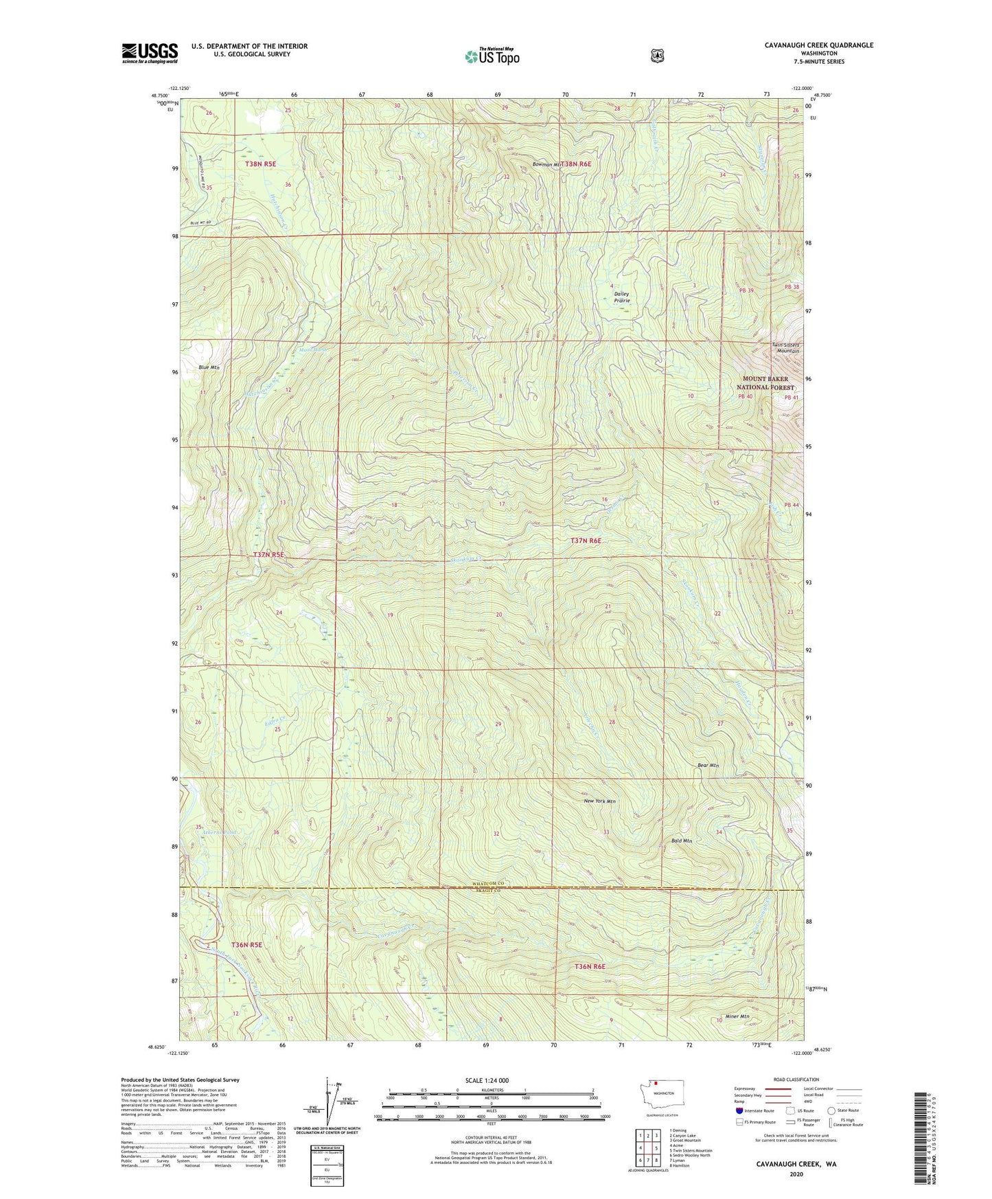
2023 topographic map quadrangle Cavanaugh Creek in the state of Washington. Scale: 1:24000. Based on the newly updated USGS 7.5' US Topo map series, this map is in the following counties: Whatcom, Skagit. The map contains contour data, water features, and other items you are used to seeing on USGS maps, but also has updated roads and other features. This is the next generation of topographic maps. Printed on high-quality waterproof paper with UV fade-resistant inks.
Quads adjacent to this one:
West: Acme
Northwest: Deming
North: Canyon Lake
Northeast: Groat Mountain
East: Twin Sisters Mountain
Southeast: Hamilton
South: Lyman
Southwest: Sedro-Woolley North
This map covers the same area as the classic USGS quad with code o48122f1.
Contains the following named places: Arlecho Creek, Atherns Pond, Bald Mountain, Bear Mountain, Bowman Mountain, Cavanaugh Creek, Dailey Prairie, Dyes Ranch, Fish Creek, Hayden Creek, Miner Mountain, Musto Marsh, New York Mountain, Orsino Creek, Peterson Creek, Swen Larsen Quarry