MyTopo
Diablo Dam Washington US Topo Map
Couldn't load pickup availability
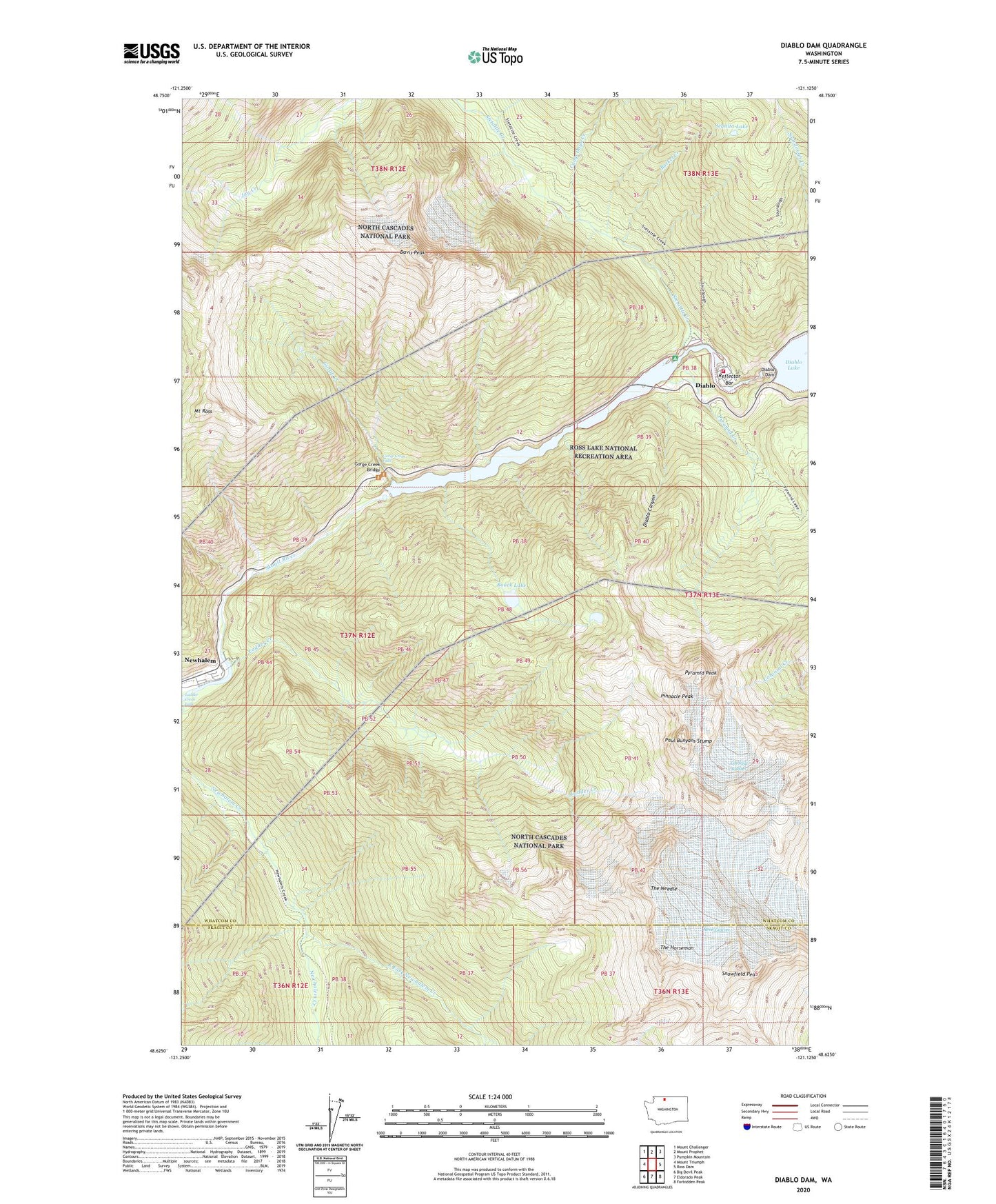
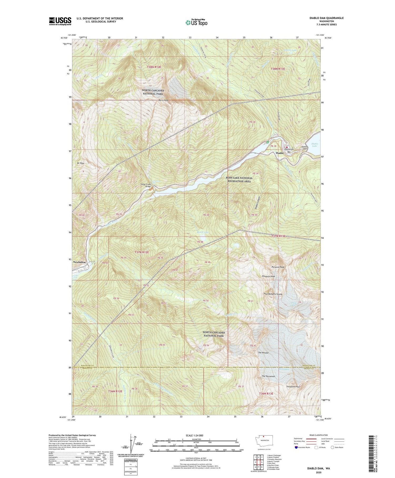
2023 topographic map quadrangle Diablo Dam in the state of Washington. Scale: 1:24000. Based on the newly updated USGS 7.5' US Topo map series, this map is in the following counties: Whatcom, Skagit. The map contains contour data, water features, and other items you are used to seeing on USGS maps, but also has updated roads and other features. This is the next generation of topographic maps. Printed on high-quality waterproof paper with UV fade-resistant inks.
Quads adjacent to this one:
West: Mount Triumph
Northwest: Mount Challenger
North: Mount Prophet
Northeast: Pumpkin Mountain
East: Ross Dam
Southeast: Forbidden Peak
South: Eldorado Peak
Southwest: Big Devil Peak
This map covers the same area as the classic USGS quad with code o48121f2.
Contains the following named places: Bouck Lake, Bucket Creek, Camp Dayo Creek, Colonial Glacier, Davis Peak, Diablo, Diablo Canyon, Diablo Dam, East Fork Newhalem Creek, Gorge Creek, Gorge Creek Bridge, Gorge Creek Falls, Gorge Creek Falls Viewpoint, Gorge Dam, Gorge Lake, Gorge Powerhouse, Jeanita Lake, Ladder Creek, Ladder Creek Falls, Mount Ross, Neve Glacier, Newhalem, Newhalem / Diablo Volunteer Fire Department, Newhalem Creek Powerhouse, Paul Bunyans Stump, Pinnacle Peak, Pyramid Creek, Pyramid Lake Research Natural Area, Pyramid Lake Trail, Pyramid Peak, Reflector Bar, Snowfield Peak, Sourdough Lookout Trail, Stephen Mather Wilderness, Stetattle Creek, The Horseman, The Needle