MyTopo
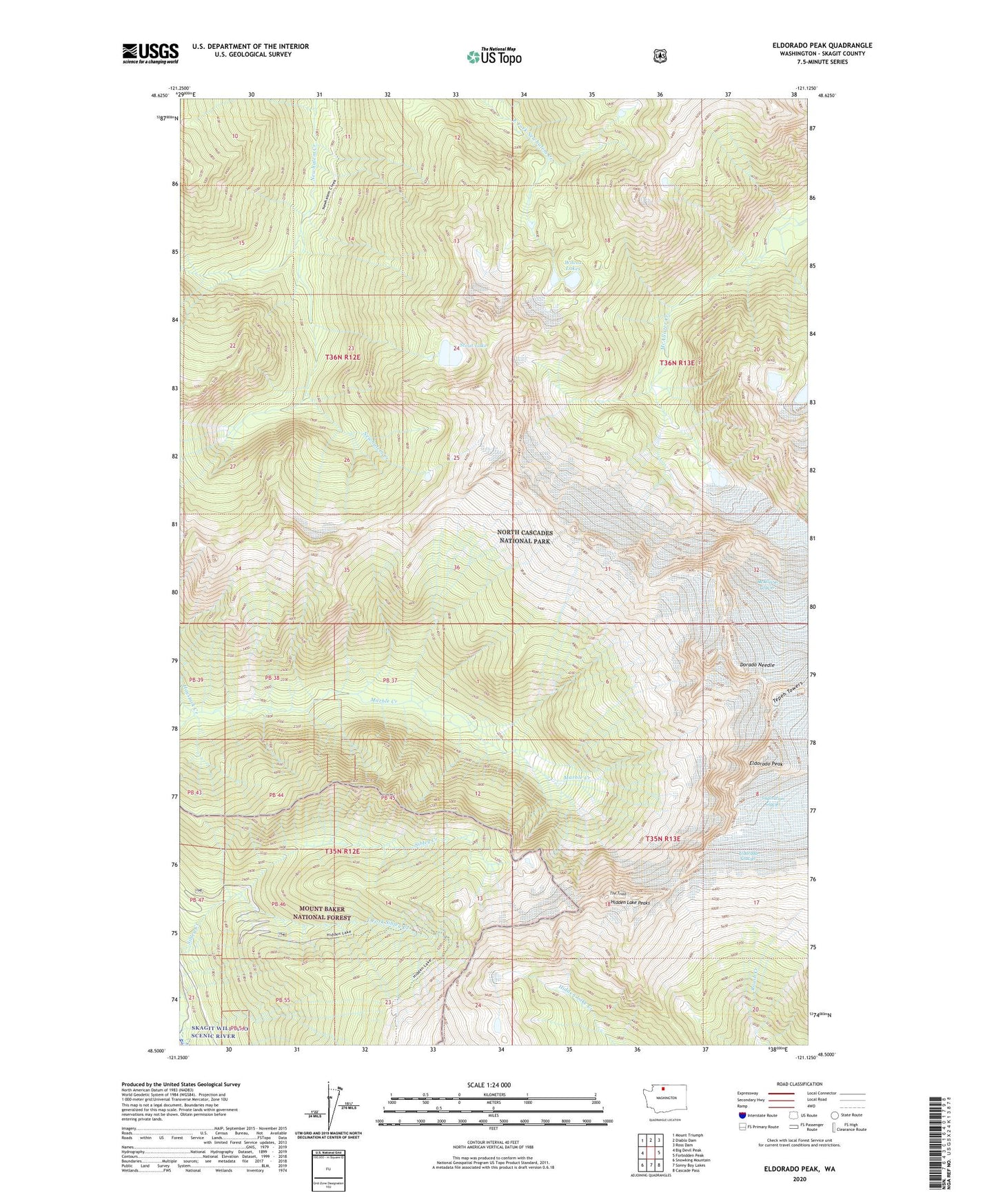
Eldorado Peak Washington US Topo Map
Couldn't load pickup availability
Also explore the Eldorado Peak Forest Service Topo of this same quad for updated USFS data
2023 topographic map quadrangle Eldorado Peak in the state of Washington. Scale: 1:24000. Based on the newly updated USGS 7.5' US Topo map series, this map is in the following counties: Skagit. The map contains contour data, water features, and other items you are used to seeing on USGS maps, but also has updated roads and other features. This is the next generation of topographic maps. Printed on high-quality waterproof paper with UV fade-resistant inks.
Quads adjacent to this one:
West: Big Devil Peak
Northwest: Mount Triumph
North: Diablo Dam
Northeast: Ross Dam
East: Forbidden Peak
Southeast: Cascade Pass
South: Sonny Boy Lakes
Southwest: Snowking Mountain
This map covers the same area as the classic USGS quad with code o48121e2.
Contains the following named places: Crescent Mine, Dorado Needle, East Fork Sibley Creek, Eldorado Glacier, Eldorado Peak, Haystack Creek, Hidden Lake Peaks, Hidden Lake Trail, Stout Lake, Tepeh Towers, The Triad, Wilcox Lakes