MyTopo
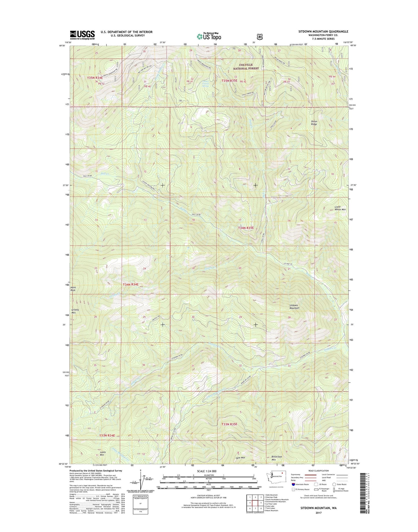
Sitdown Mountain Washington US Topo Map
Couldn't load pickup availability
Also explore the Sitdown Mountain Forest Service Topo of this same quad for updated USFS data
2023 topographic map quadrangle Sitdown Mountain in the state of Washington. Scale: 1:24000. Based on the newly updated USGS 7.5' US Topo map series, this map is in the following counties: Ferry. The map contains contour data, water features, and other items you are used to seeing on USGS maps, but also has updated roads and other features. This is the next generation of topographic maps. Printed on high-quality waterproof paper with UV fade-resistant inks.
Quads adjacent to this one:
West: Seventeenmile Mountain
Northwest: Edds Mountain
North: Sherman Peak
Northeast: South Huckleberry Mountain
East: La Fleur Lake
Southeast: Moon Mountain
South: Twin Lakes
Southwest: Cody Lake
This map covers the same area as the classic USGS quad with code o48118d4.
Contains the following named places: Bitterfoot Mountain, Buckskin Creek Campground, Grizzly Creek, Grizzly Mountain, Johns Mountain, Johns Mountain Creek, Little White Mountain, Lynx Creek Lookout, Lynx Mountain, Onion Ridge, Sitdown Creek, Sitdown Mountain, Sleepy Hollow Creek, Stall Creek, Tanker Chance Spring, White Mountain Trail