MyTopo
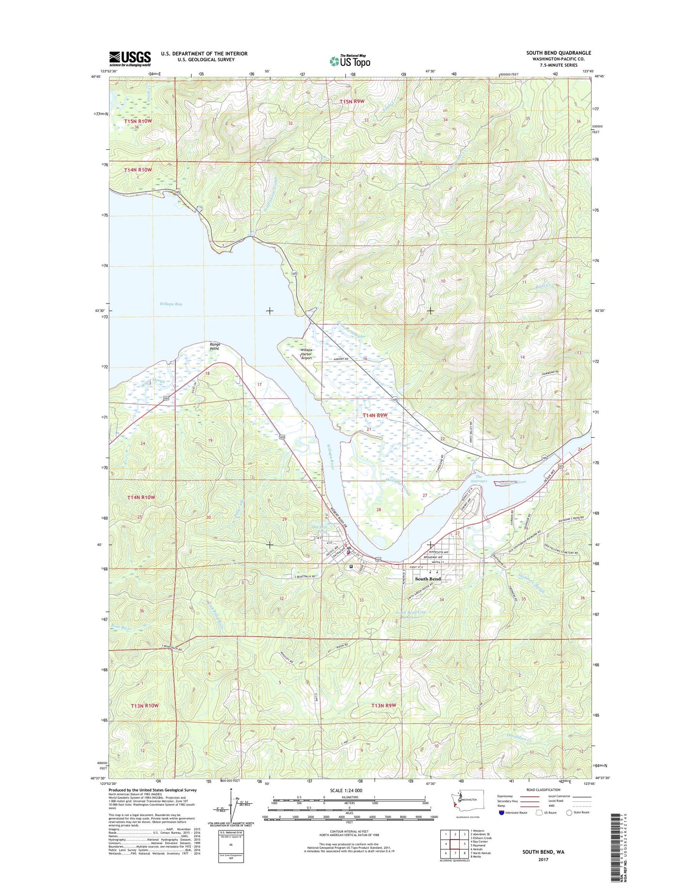
South Bend Washington US Topo Map
Couldn't load pickup availability
2023 topographic map quadrangle South Bend in the state of Washington. Scale: 1:24000. Based on the newly updated USGS 7.5' US Topo map series, this map is in the following counties: Pacific. The map contains contour data, water features, and other items you are used to seeing on USGS maps, but also has updated roads and other features. This is the next generation of topographic maps. Printed on high-quality waterproof paper with UV fade-resistant inks.
Quads adjacent to this one:
West: Bay Center
Northwest: Western
North: Aberdeen SE
Northeast: Elkhorn Creek
East: Raymond
Southeast: Menlo
South: North Nemah
Southwest: Nemah
This map covers the same area as the classic USGS quad with code o46123f7.
Contains the following named places: Alder House Assisted Living Facility, Bale Dam Number One, Bale Dam Number Two, Chauncey Davis Elementary School, City of South Bend, Electric Creek Dam, First Baptist Church, First Lutheran Church, Fredrickson Slough, Grace Community Church, I I Slough, Johnson Slough, KAPA-AM (Raymond), Kellogg Slough, KSWW-FM (Raymond), Mailboat Slough, Martin Creek Dam, Milne Quarry, Old Mill Pond, Old Mill Pond Dam, Pacific County Courthouse, Pacific County Courthouse Annex, Pacific County Museum, Pacific County Sheriff's Office South Bend, Potter Slough, Range Point, Raymond Division, Seahaven, Skidmore Slough, Smith Creek State Wildlife Recreation Area, South Bend, South Bend City Reservoir, South Bend City Reservoir Dam, South Bend Early Learning Center, South Bend High School, South Bend Police Department, South Bend Post Office, South Bend School District Office, South Bend Sewage Treatment Plant, South Bend Timberland Library, South Bend United Methodist Church, South Bend Volunteer Fire Department, Stuart Slough, The Narrows, Welsh Ranch, Willapa Harbor Airport, Willapa Harbor Heliport, Willapa Harbor Hospital, Willapa River