MyTopo
Ellensburg North Washington US Topo Map
Couldn't load pickup availability
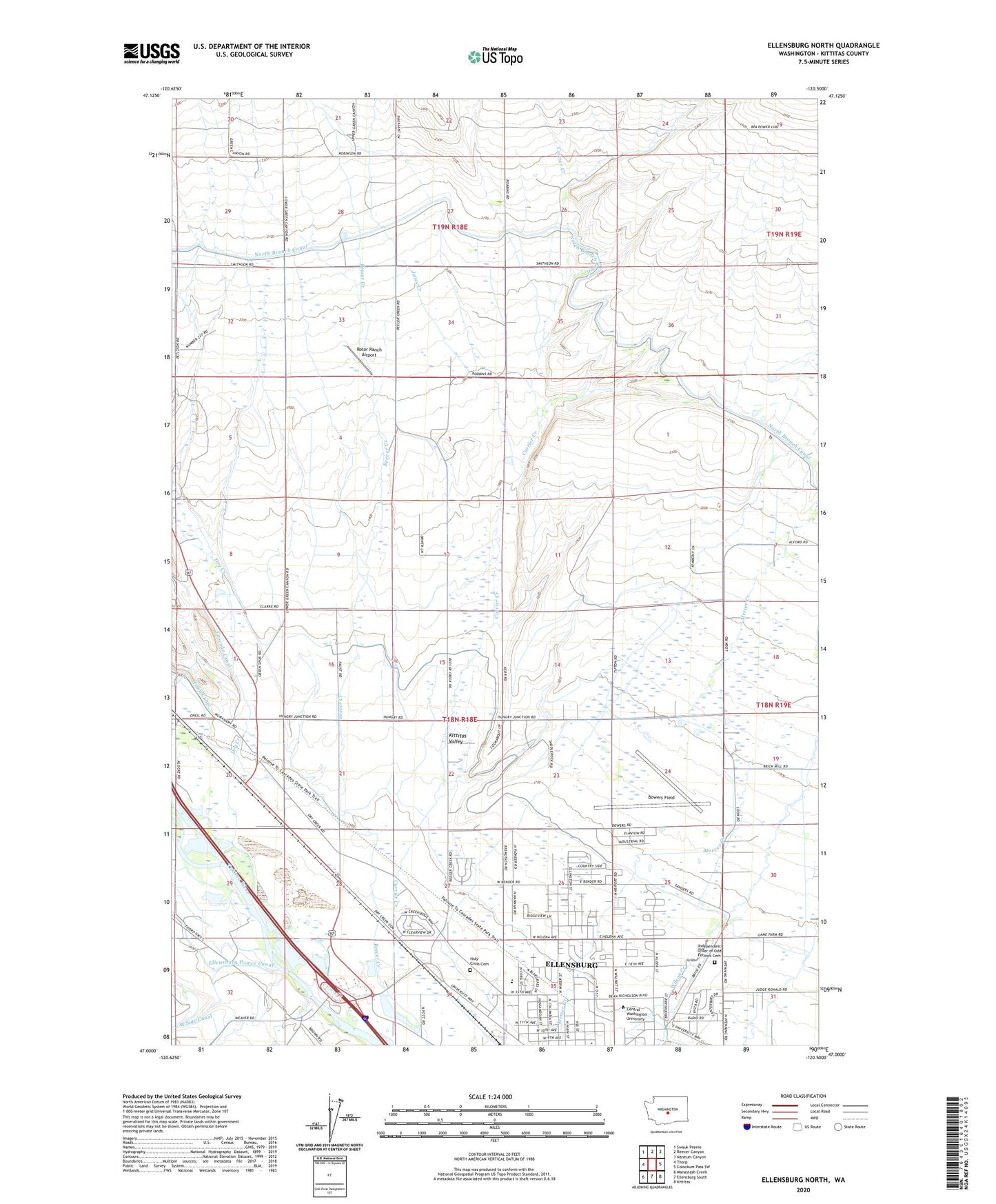
2023 topographic map quadrangle Ellensburg North in the state of Washington. Scale: 1:24000. Based on the newly updated USGS 7.5' US Topo map series, this map is in the following counties: Kittitas. The map contains contour data, water features, and other items you are used to seeing on USGS maps, but also has updated roads and other features. This is the next generation of topographic maps. Printed on high-quality waterproof paper with UV fade-resistant inks.
Quads adjacent to this one:
West: Thorp
Northwest: Swauk Prairie
North: Reecer Canyon
Northeast: Naneum Canyon
East: Colockum Pass SW
Southeast: Kittitas
South: Ellensburg South
Southwest: Manastash Creek
This map covers the same area as the classic USGS quad with code o47120a5.
Contains the following named places: Bouillon Library, Bowers Field, Central Washington University, Currier Creek, Dry Creek, Ellensburg Army Air Field, Ellensburg Golf Club, Hebeler Elementary School, Holy Cross Cemetery, Independent Order of Odd Fellows Cemetery, Jones Creek, Kittitas Valley, Kiwanis Park, KQBE-FM (Ellensburg), Mount Stuart Elementary School, Nicholson Pavilion, Reecer Creek School, West Ranch Airport, Woldale, Woldale School