MyTopo
Thorp Washington US Topo Map
Couldn't load pickup availability
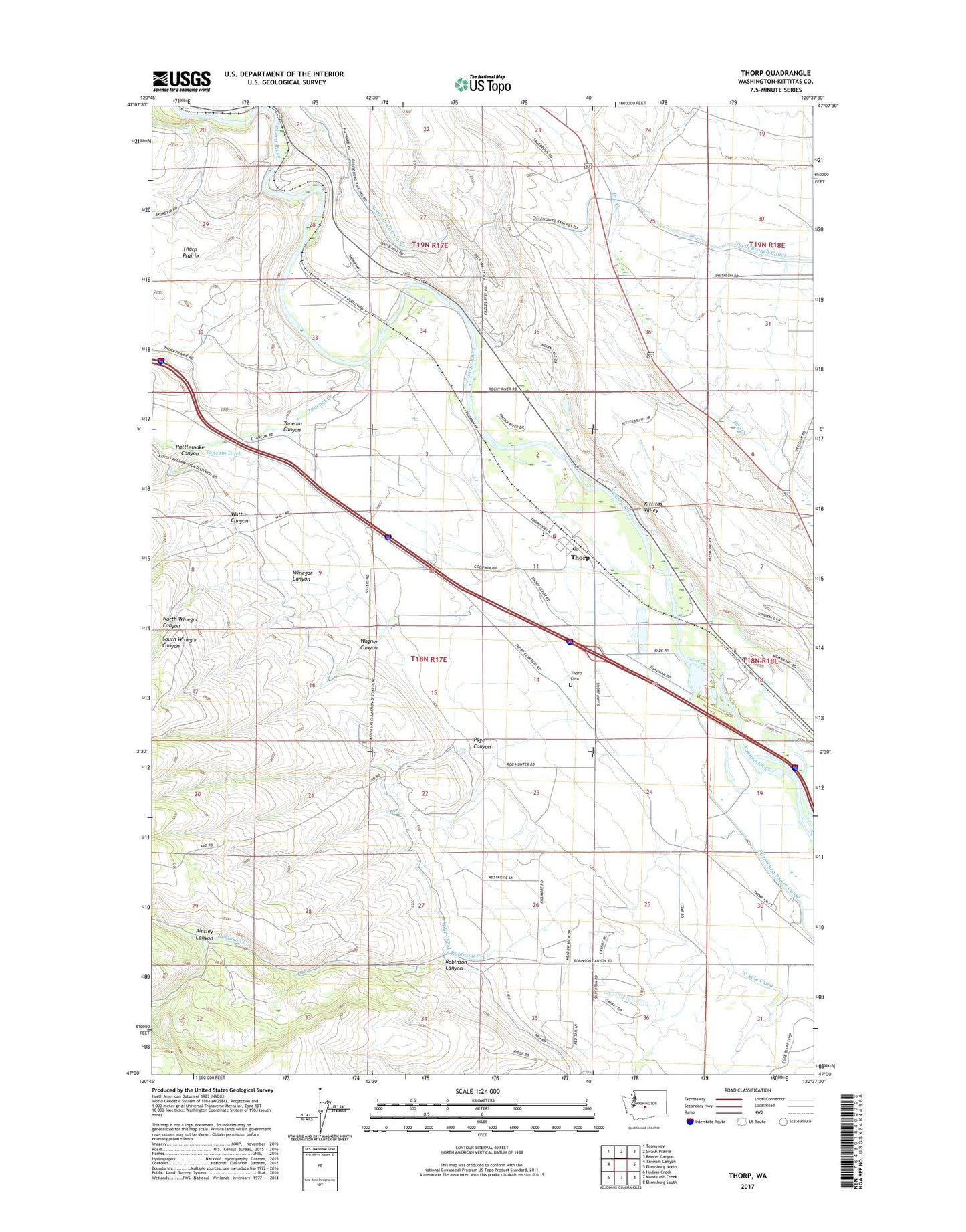
2023 topographic map quadrangle Thorp in the state of Washington. Scale: 1:24000. Based on the newly updated USGS 7.5' US Topo map series, this map is in the following counties: Kittitas. The map contains contour data, water features, and other items you are used to seeing on USGS maps, but also has updated roads and other features. This is the next generation of topographic maps. Printed on high-quality waterproof paper with UV fade-resistant inks.
Quads adjacent to this one:
West: Taneum Canyon
Northwest: Teanaway
North: Swauk Prairie
Northeast: Reecer Canyon
East: Ellensburg North
Southeast: Ellensburg South
South: Manastash Creek
Southwest: Hudson Creek
This map covers the same area as the classic USGS quad with code o47120a6.
Contains the following named places: Ainsley Canyon, Blowout Bench Airport, Dudley, Ellensburg Power Canal, High Valley Memorial Park Cemetery, Kittitas County, Kittitas County Fire District 1, North Winegar Canyon, Page Canyon, Rattlesnake Canyon, Ridgeway School, Robinson Canyon, Robinson Creek, South Branch Canal, South Winegar Canyon, Swauk Creek, Taneum Canyon, Taneum Creek, Taneum Ditch, Thorp, Thorp Cemetery, Thorp Census Designated Place, Thorp Elementary and Junior Senior High School, Thorp Post Office, Wagner Canyon, Watt Canyon, West Side Canal, Winegar Canyon, ZIP Code: 98946