MyTopo
Setters Idaho US Topo Map
Couldn't load pickup availability
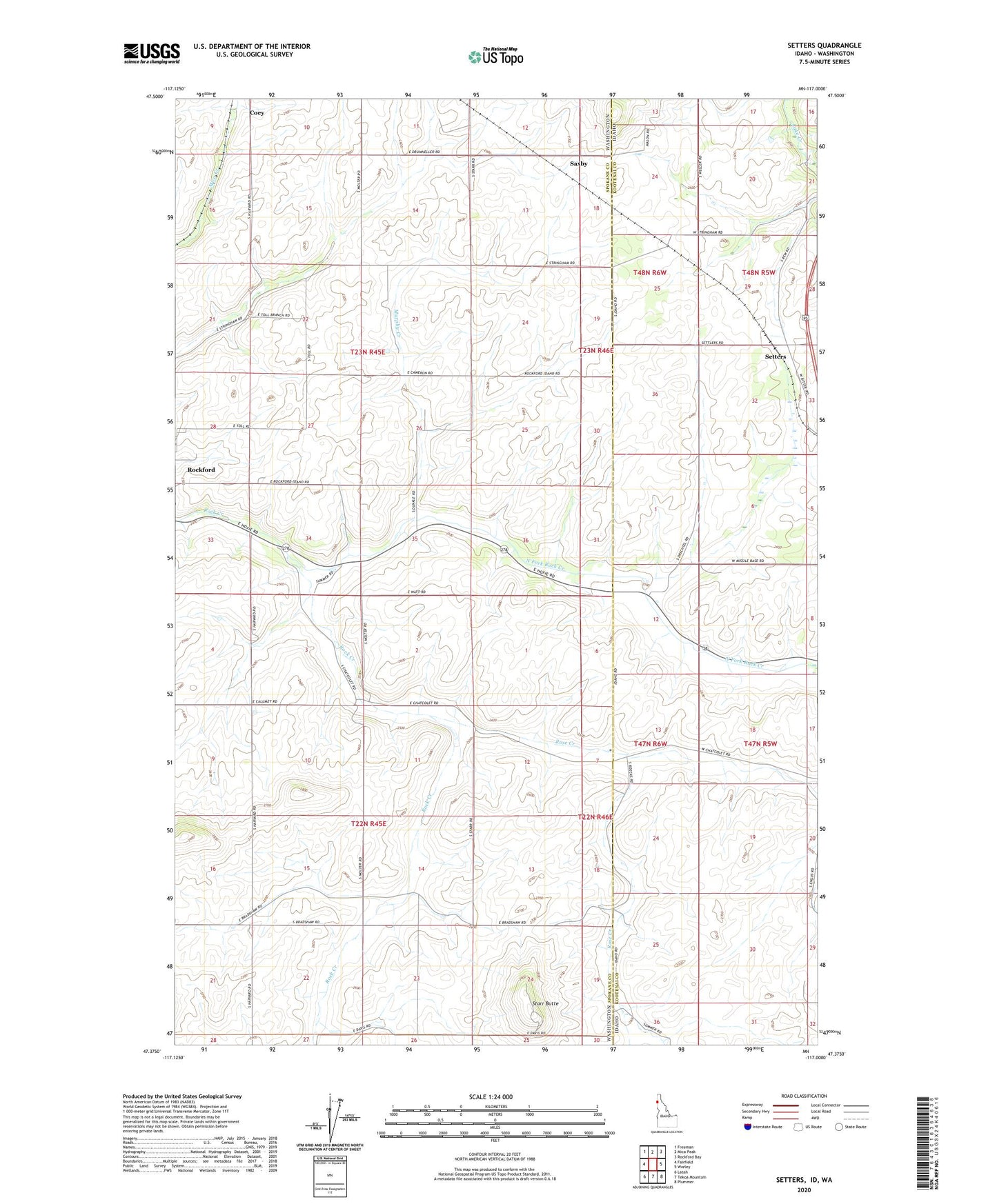
2024 topographic map quadrangle Setters in the states of Washington, Idaho. Scale: 1:24000. Based on the newly updated USGS 7.5' US Topo map series, this map is in the following counties: Kootenai, Spokane. The map contains contour data, water features, and other items you are used to seeing on USGS maps, but also has updated roads and other features. This is the next generation of topographic maps. Printed on high-quality waterproof paper with UV fade-resistant inks.
Quads adjacent to this one:
West: Fairfield
Northwest: Freeman
North: Mica Peak
Northeast: Rockford Bay
East: Worley
Southeast: Plummer
South: Tekoa Mountain
Southwest: Latah
Contains the following named places: Coey, Ford, Ford School, La Shaw School, McGowan Butte, McIntosh Grange, Murphy Creek, North Fork Rock Creek, Rock Creek Gun Club, Rose Creek, Saxby, Setters, South Fork Rock Creek, Starr Butte, ZIP Code: 99030