MyTopo
Gifford Peak Washington US Topo Map
Couldn't load pickup availability
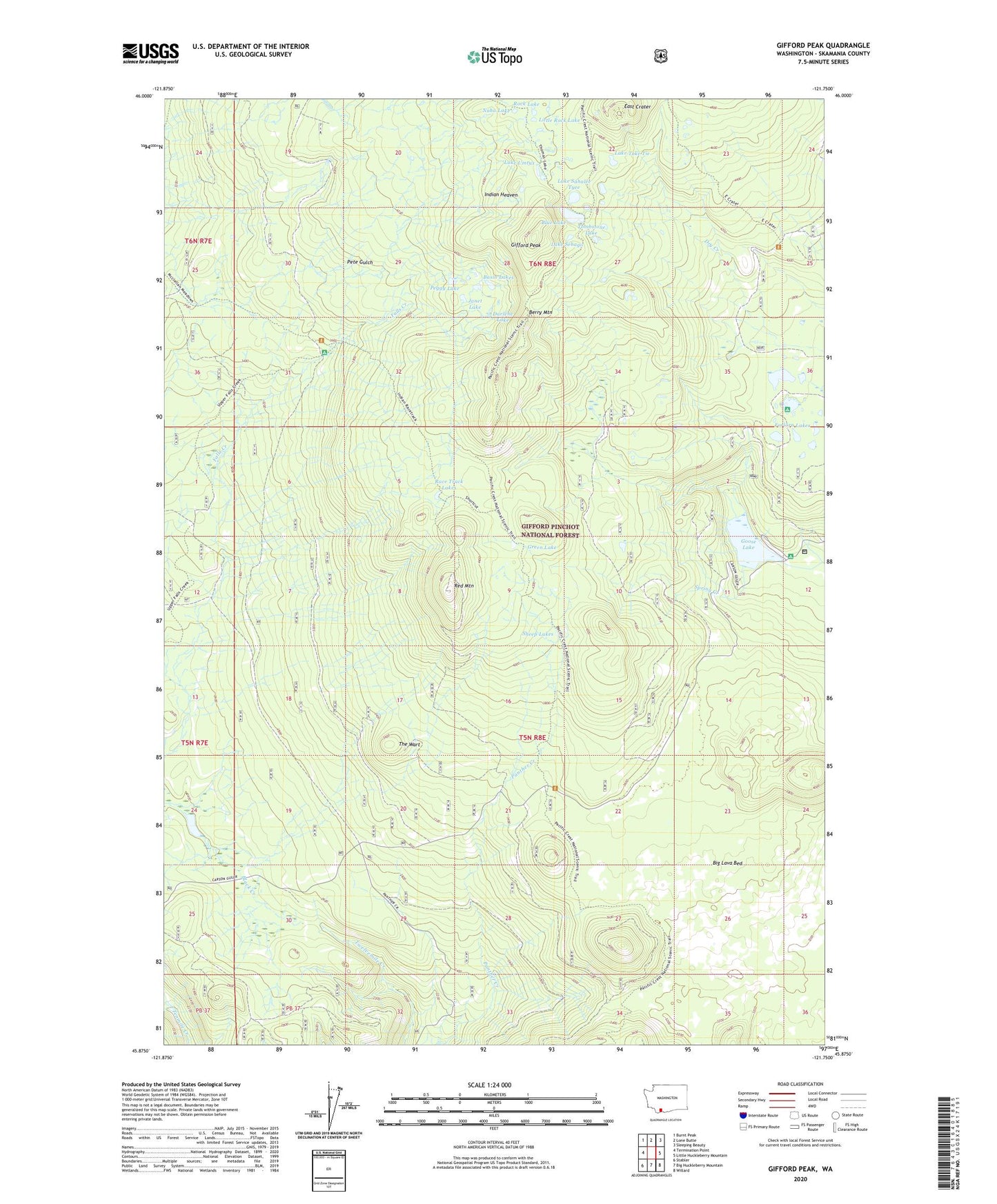
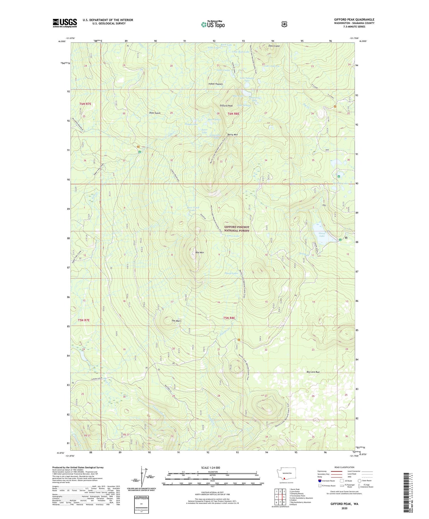
2020 topographic map quadrangle Gifford Peak in the state of Washington. Scale: 1:24000. Based on the newly updated USGS 7.5' US Topo map series, this map is in the following counties: Skamania. The map contains contour data, water features, and other items you are used to seeing on USGS maps, but also has updated roads and other features. This is the next generation of topographic maps. Printed on high-quality waterproof paper with UV fade-resistant inks.
Quads adjacent to this one:
West: Termination Point
Northwest: Burnt Peak
North: Lone Butte
Northeast: Sleeping Beauty
East: Little Huckleberry Mountain
Southeast: Willard
South: Big Huckleberry Mountain
Southwest: Stabler
Contains the following named places: Basin Lakes, Berry Mountain, Black Creek Forest Camp, Blue Lake, Crest Camp, Darlene Lake, East Crater, East Crater Trail, Falls Creek Horse Camp, Forlorn Lakes, Forlorn Lakes Campground, Gifford Peak, Goose Lake, Goose Lake Campground, Green Lake, Indian Heaven, Indian Race Track, Janet Lake, Lake Sahalee Tyee, Lake Sebago, Lake Toke Tie, Lake Umtux, Little Rock Lake, Naha Lake, Peggy Lake, Race Track Lakes, Racetrack, Racetrack Forest Camp, Red Mountain, Red Mountain Lookout, Rock Lake, Sheep Lakes, Spring Camp, Spring Creek, The Wart, Tombstone Lake