MyTopo
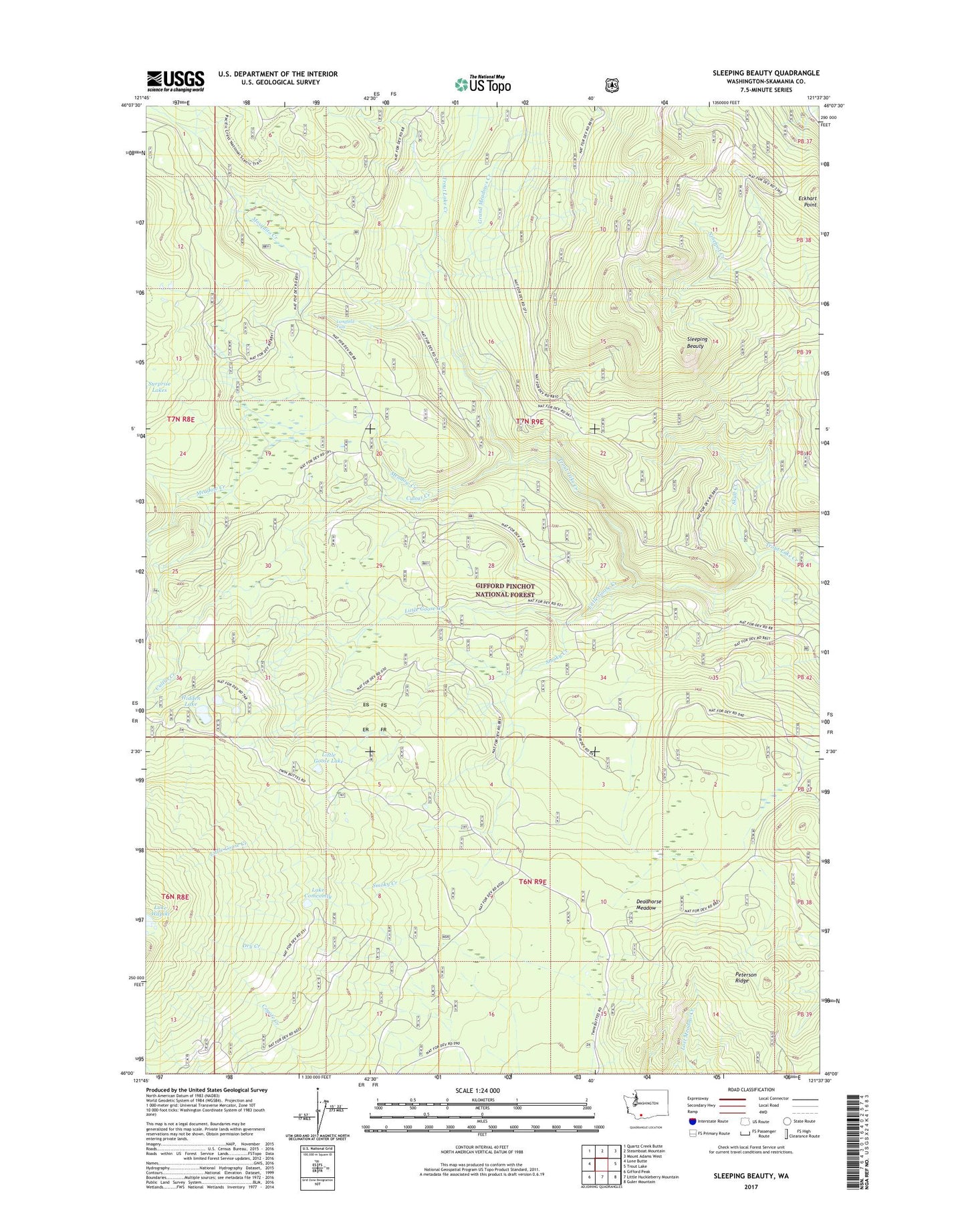
Sleeping Beauty Washington US Topo Map
Couldn't load pickup availability
Also explore the Sleeping Beauty Forest Service Topo of this same quad for updated USFS data
2023 topographic map quadrangle Sleeping Beauty in the state of Washington. Scale: 1:24000. Based on the newly updated USGS 7.5' US Topo map series, this map is in the following counties: Skamania. The map contains contour data, water features, and other items you are used to seeing on USGS maps, but also has updated roads and other features. This is the next generation of topographic maps. Printed on high-quality waterproof paper with UV fade-resistant inks.
Quads adjacent to this one:
West: Lone Butte
Northwest: Quartz Creek Butte
North: Steamboat Mountain
Northeast: Mount Adams West
East: Trout Lake
Southeast: Guler Mountain
South: Little Huckleberry Mountain
Southwest: Gifford Peak
This map covers the same area as the classic USGS quad with code o46121a6.
Contains the following named places: Cultus Creek, Deadhorse Meadow, Hidden Lake, Lake Comcomly, Lake Wapiki, Langfield Falls, Little Goose Campground, Little Goose Creek, Little Goose Lake, Meadow Creek, Mosquito Creek, North Fork Meadow Creek, Peterson Ridge, Skull Creek, Sleeping Beauty, Sleeping Beauty Lookout, Smoky Creek, Smoky Creek Campground, Tire Junction