MyTopo
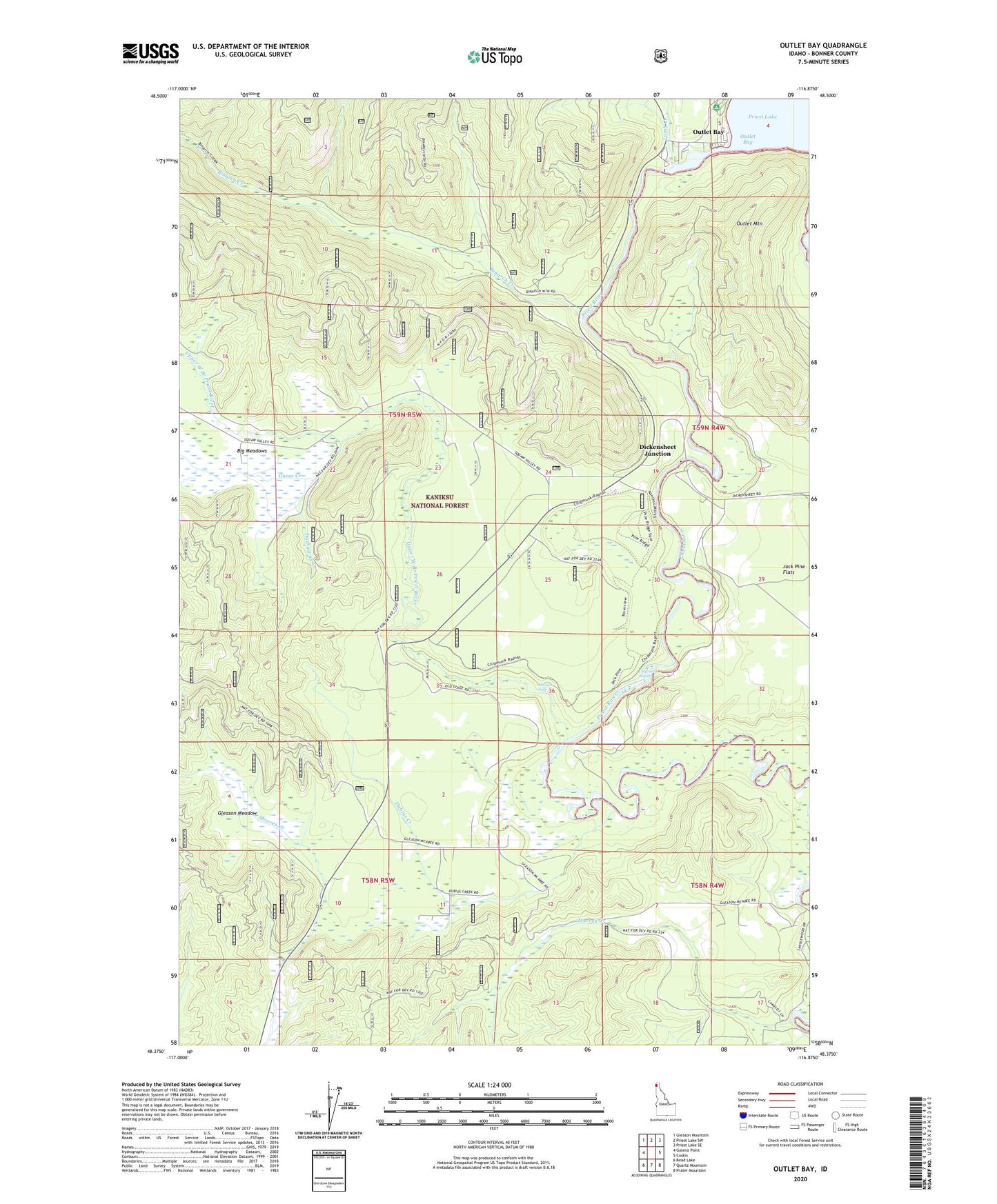
Outlet Bay Idaho US Topo Map
Couldn't load pickup availability
Also explore the Outlet Bay Forest Service Topo of this same quad for updated USFS data
2024 topographic map quadrangle Outlet Bay in the state of Idaho. Scale: 1:24000. Based on the newly updated USGS 7.5' US Topo map series, this map is in the following counties: Bonner. The map contains contour data, water features, and other items you are used to seeing on USGS maps, but also has updated roads and other features. This is the next generation of topographic maps. Printed on high-quality waterproof paper with UV fade-resistant inks.
Quads adjacent to this one:
West: Galena Point
Northwest: Gleason Mountain
North: Priest Lake SW
Northeast: Priest Lake SE
East: Coolin
Southeast: Prater Mountain
South: Quartz Mountain
Southwest: Bead Lake
This map covers the same area as the classic USGS quad with code o48116d8.
Contains the following named places: Binarch Creek, Blonc Creek, Canoe Camp, Chipmunk Rapids, Chipmunk Rapids National Recreation Trail, Cottonwood Creek, Dickensheet Campground, Dickensheet Junction, Dubius Creek, Gleason Meadow, Goose Creek, Hathaway Creek, Kaniksu Marsh Research Natural Area, Lamb Creek, Mission Falls, Murray Creek, Outlet Bay, Outlet Campground, Outlet Dam, Outlet Mountain, Priest Lake Dam, Priest River Division, Upper West Branch Priest River