MyTopo
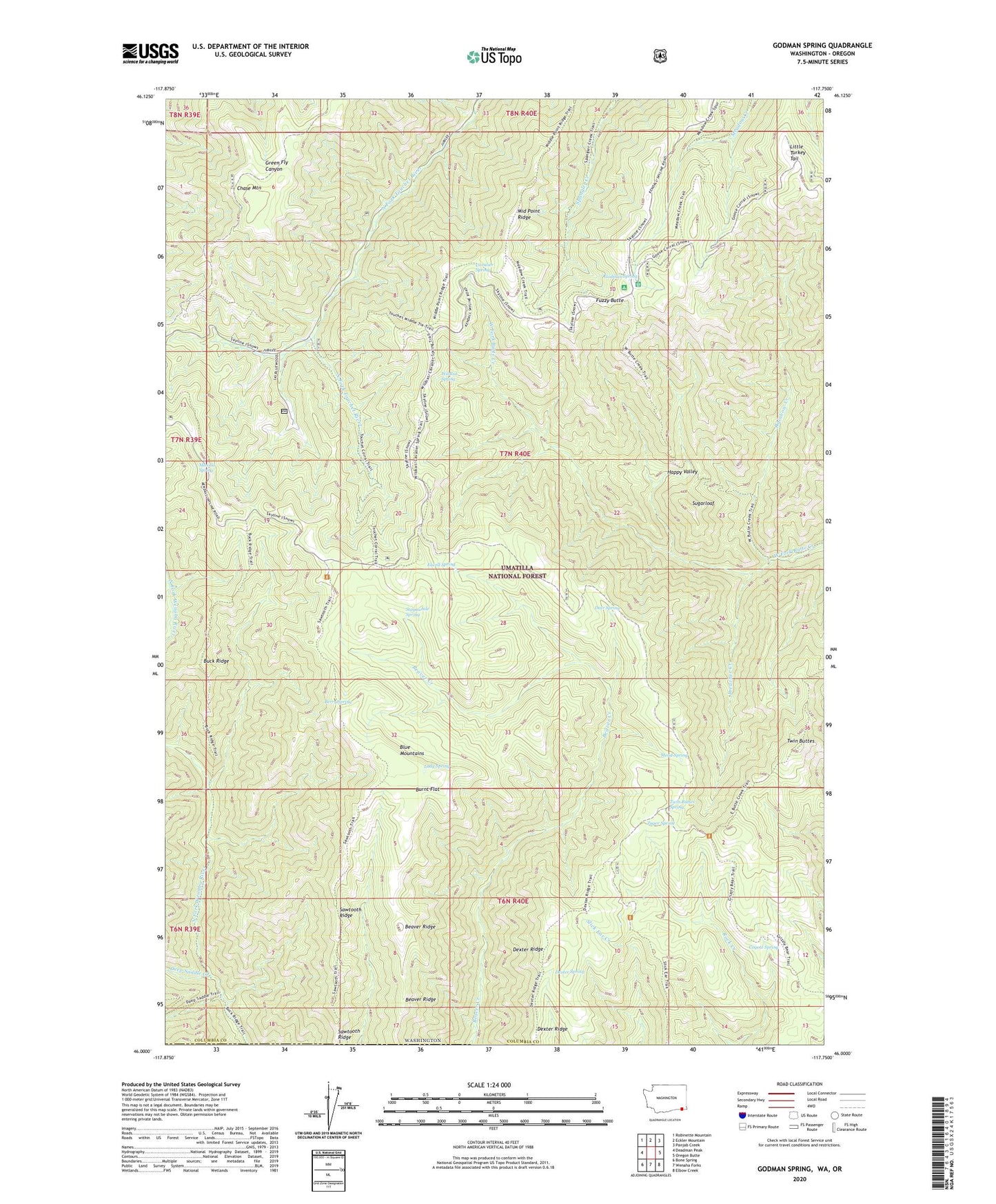
Godman Spring Washington US Topo Map
Couldn't load pickup availability
Also explore the Godman Spring Forest Service Topo of this same quad for updated USFS data
2023 topographic map quadrangle Godman Spring in the state of Washington. Scale: 1:24000. Based on the newly updated USGS 7.5' US Topo map series, this map is in the following counties: Columbia, Wallowa. The map contains contour data, water features, and other items you are used to seeing on USGS maps, but also has updated roads and other features. This is the next generation of topographic maps. Printed on high-quality waterproof paper with UV fade-resistant inks.
Quads adjacent to this one:
West: Deadman Peak
Northwest: Robinette Mountain
North: Eckler Mountain
Northeast: Panjab Creek
East: Oregon Butte
Southeast: Elbow Creek
South: Wenaha Forks
Southwest: Bone Spring
This map covers the same area as the classic USGS quad with code o46117a7.
Contains the following named places: Beaver Ridge, Berry Spring, Bluewood Ski Area, Buck Ridge, Burnt Flat, Burnt Flat Corral, Cavalier Spring, Chase Mountain, Coyote Spring, Deep Saddle Creek, Deer Spring, Dexter Ridge, Dexter Ridge Trail, Dexter Spring, Elwell Spring, Fuzzy Butte, Godman Campground, Godman Guard Station, Godman Spring, Grizzly Bear Trail, Happy Valley, Lady Camp, Lady Spring, Little Turkey Recreation Residence, Little Turkey Tail, Manilla Spring, Mead Spring, Middle Point Ridge, Preacher Creek, Rainbow Creek, Rainbow Creek Research Natural Area, Sawtooth Ridge, Sawtooth Trail, Slick Ear Trail, Stayawhile Spring, Sugarloaf, Touchet Sno-Park, Twin Buttes, Twin Buttes Spring, West Butte Creek Trail, Wildcat Spring, Zuger Spring