MyTopo
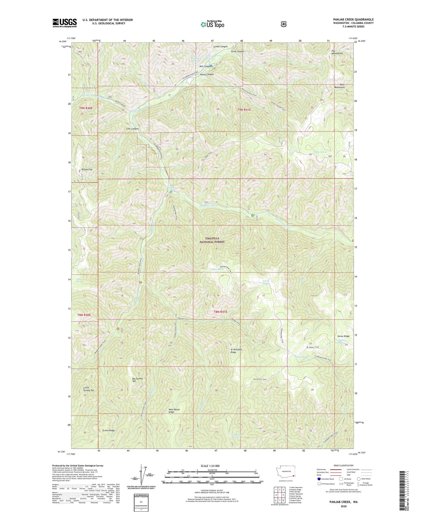
Panjab Creek Washington US Topo Map
Couldn't load pickup availability
Also explore the Panjab Creek Forest Service Topo of this same quad for updated USFS data
2023 topographic map quadrangle Panjab Creek in the state of Washington. Scale: 1:24000. Based on the newly updated USGS 7.5' US Topo map series, this map is in the following counties: Columbia. The map contains contour data, water features, and other items you are used to seeing on USGS maps, but also has updated roads and other features. This is the next generation of topographic maps. Printed on high-quality waterproof paper with UV fade-resistant inks.
Quads adjacent to this one:
West: Eckler Mountain
Northwest: Cahill Mountain
North: Hopkins Ridge
Northeast: Rose Springs
East: Stentz Spring
Southeast: Diamond Peak
South: Oregon Butte
Southwest: Godman Spring
This map covers the same area as the classic USGS quad with code o46117b6.
Contains the following named places: Al Williams Ridge, Alnus Spring, Bear Spring, Bullfrog Spring, Camp Wooten Environmental Learning Center, Camp Wooten State Park, Cascara Spring, Cold Creek, Cow Canyon, Dunlap Spring, Grub Canyon, Hixon Canyon, Indian Corral, Little Tucannon River, Meadow Creek, Mill Canyon, Mill Canyon Spring, Mount Misery Trail, Panjab Campground, Panjab Creek, Panjab Trail, Panjab Trailhead, Rattlesnake Trail, Red Fir Spring, Salter Trail, School Canyon, Table Camp, Tablecamp Spring, Tallow Flat, The Wheatfield, Tucannon Campground, Tucannon Game Reserve, Tucannon Spring, Turkey Creek, Turkey Creek Trail, Willow Spring