MyTopo
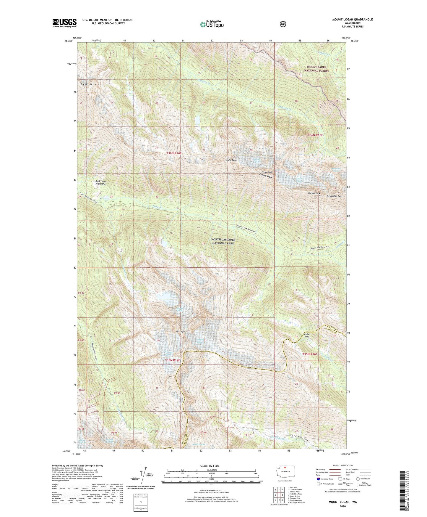
Mount Logan Washington US Topo Map
Couldn't load pickup availability
Also explore the Mount Logan Forest Service Topo of this same quad for updated USFS data
2023 topographic map quadrangle Mount Logan in the state of Washington. Scale: 1:24000. Based on the newly updated USGS 7.5' US Topo map series, this map is in the following counties: Skagit, Chelan. The map contains contour data, water features, and other items you are used to seeing on USGS maps, but also has updated roads and other features. This is the next generation of topographic maps. Printed on high-quality waterproof paper with UV fade-resistant inks.
Quads adjacent to this one:
West: Forbidden Peak
Northwest: Ross Dam
North: Crater Mountain
Northeast: Azurite Peak
East: Mount Arriva
Southeast: McGregor Mountain
South: Goode Mountain
Southwest: Cascade Pass
This map covers the same area as the classic USGS quad with code o48120e8.
Contains the following named places: Banded Glacier, Cosho Peak, Douglas Glacier, Fisher Pass, Fremont Glacier, Katsuk Glacier, Katsuk Peak, Kimtah Glacier, Kimtah Peak, Logan Creek, Mesahchie Peak, Mount Logan, Ragged Ridge, Red Mountain, Rock Cabin, Rock Cabin Avalanche, Thunder Glacier