
MyTopo
Green Mountain Washington US Topo Map
Couldn't load pickup availability
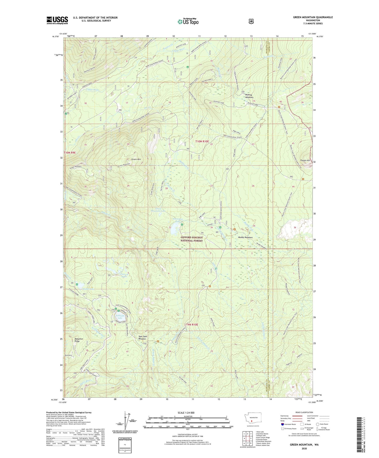
2020 topographic map quadrangle Green Mountain in the state of Washington. Scale: 1:24000. Based on the newly updated USGS 7.5' US Topo map series, this map is in the following counties: Skamania, Yakima. The map contains contour data, water features, and other items you are used to seeing on USGS maps, but also has updated roads and other features. This is the next generation of topographic maps. Printed on high-quality waterproof paper with UV fade-resistant inks.
Quads adjacent to this one:
West: East Canyon Ridge
Northwest: Blue Lake
North: Hamilton Buttes
Northeast: Walupt Lake
East: Glaciate Butte
Southeast: Mount Adams East
South: Mount Adams West
Southwest: Steamboat Mountain
Contains the following named places: Babyshoe Ridge, Cat Creek, Cat Creek Campground, Cat Creek Guard Station, Chain of Lakes, Chain of Lakes Campground, Chambers Creek, Divide Camp Trail, East Fork Adams Creek, Green Mountain, Green Mountain Lake, Horseshoe Lake, Horseshoe Lake Forest Camp, Keenes Horse Camp, Killen Creek, Killen Creek Campground, Midway Creek, Midway Guard Station, Midway Meadows, Mouse Creek, Muddy Fork, Muddy Meadows, Olallie Lake, Olallie Lake Campground, Pimlico Creek, Potato Hill, Sheep Creek, South Fork Spring Creek, Spring Creek, Spring Creek Campground, Takh Takh Meadow, Takhlakh Forest Camp, Takhlakh Lake, West Fork Adams Creek


