MyTopo
Steamboat Mountain Washington US Topo Map
Couldn't load pickup availability
Also explore the Steamboat Mountain Forest Service Topo of this same quad for updated USFS data
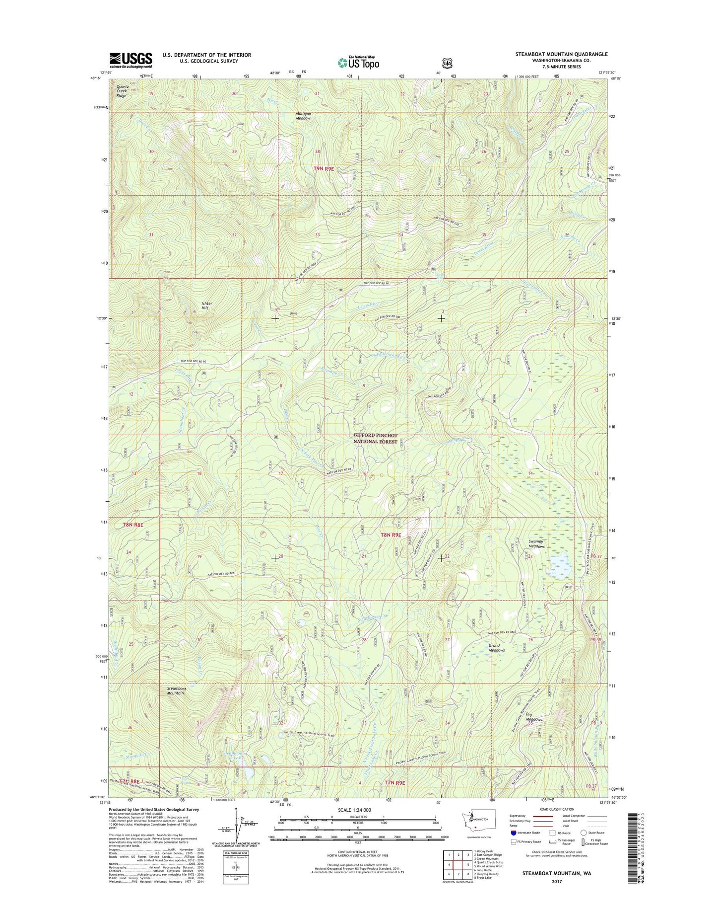
2023 topographic map quadrangle Steamboat Mountain in the state of Washington. Scale: 1:24000. Based on the newly updated USGS 7.5' US Topo map series, this map is in the following counties: Skamania. The map contains contour data, water features, and other items you are used to seeing on USGS maps, but also has updated roads and other features. This is the next generation of topographic maps. Printed on high-quality waterproof paper with UV fade-resistant inks.
Quads adjacent to this one:
West: Quartz Creek Butte
Northwest: McCoy Peak
North: East Canyon Ridge
Northeast: Green Mountain
East: Mount Adams West
Southeast: Trout Lake
South: Sleeping Beauty
Southwest: Lone Butte
This map covers the same area as the classic USGS quad with code o46121b6.
Contains the following named places: Big Spring Creek, Boulder Creek, Cold Spring, Deer Creek, Dry Meadows, Grand Meadows, Grand Meadows Creek, Ichter Hill, Island Shelter, Little Fish Lake, Mulligan Meadow, Noname Creek, North Fork Pass Creek, North Fork Swampy Creek, North Fork Trout Lake Creek, Pass Creek, Pin Creek, Poison Creek, Riley Creek, South Fork Pass Creek, Steamboat Creek, Steamboat Lake, Steamboat Lake Campground, Steamboat Mountain, Steamboat Mountain Research Natural Area, Swampy Creek, Swampy Meadows, Table Mountain Trail, Twin Falls, Twin Falls Campground, Twin Falls Creek, Williams Mine