MyTopo
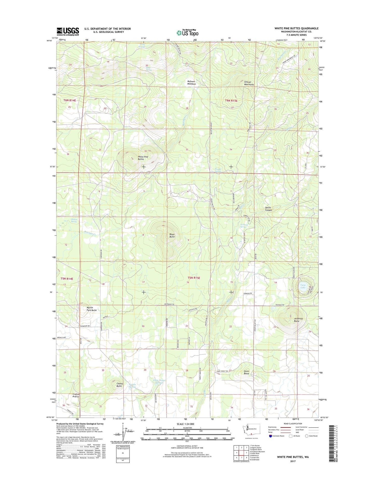
White Pine Buttes Washington US Topo Map
Couldn't load pickup availability
2023 topographic map quadrangle White Pine Buttes in the state of Washington. Scale: 1:24000. Based on the newly updated USGS 7.5' US Topo map series, this map is in the following counties: Klickitat. The map contains contour data, water features, and other items you are used to seeing on USGS maps, but also has updated roads and other features. This is the next generation of topographic maps. Printed on high-quality waterproof paper with UV fade-resistant inks.
Quads adjacent to this one:
West: Grayback Mountain
Northwest: Twin Buttes
North: Hagerty Butte
Northeast: Stagman Butte
East: Indian Rock
Southeast: Goldendale
South: Centerville
Southwest: Wahkiacus
This map covers the same area as the classic USGS quad with code o45120h8.
Contains the following named places: A J Bolon Historic Monument, Black Butte, Brownlee Corrals, Carp Lake, Case Ranch, Counts Butte, Counts Spring, Devils Canyon, Firwood, Firwood School, Gilen Water Springs, Gunn Butte, Jackknife Butte, Lower Bowman Campsite, McEwen Meadows, Myrtle Park Butte, No Name Spring, Presher Springs, Pretty Swamp, Rock Spring, Shelton Spring, Upper Bowman Campsite, White Pine Buttes