MyTopo
Indian Rock Washington US Topo Map
Couldn't load pickup availability
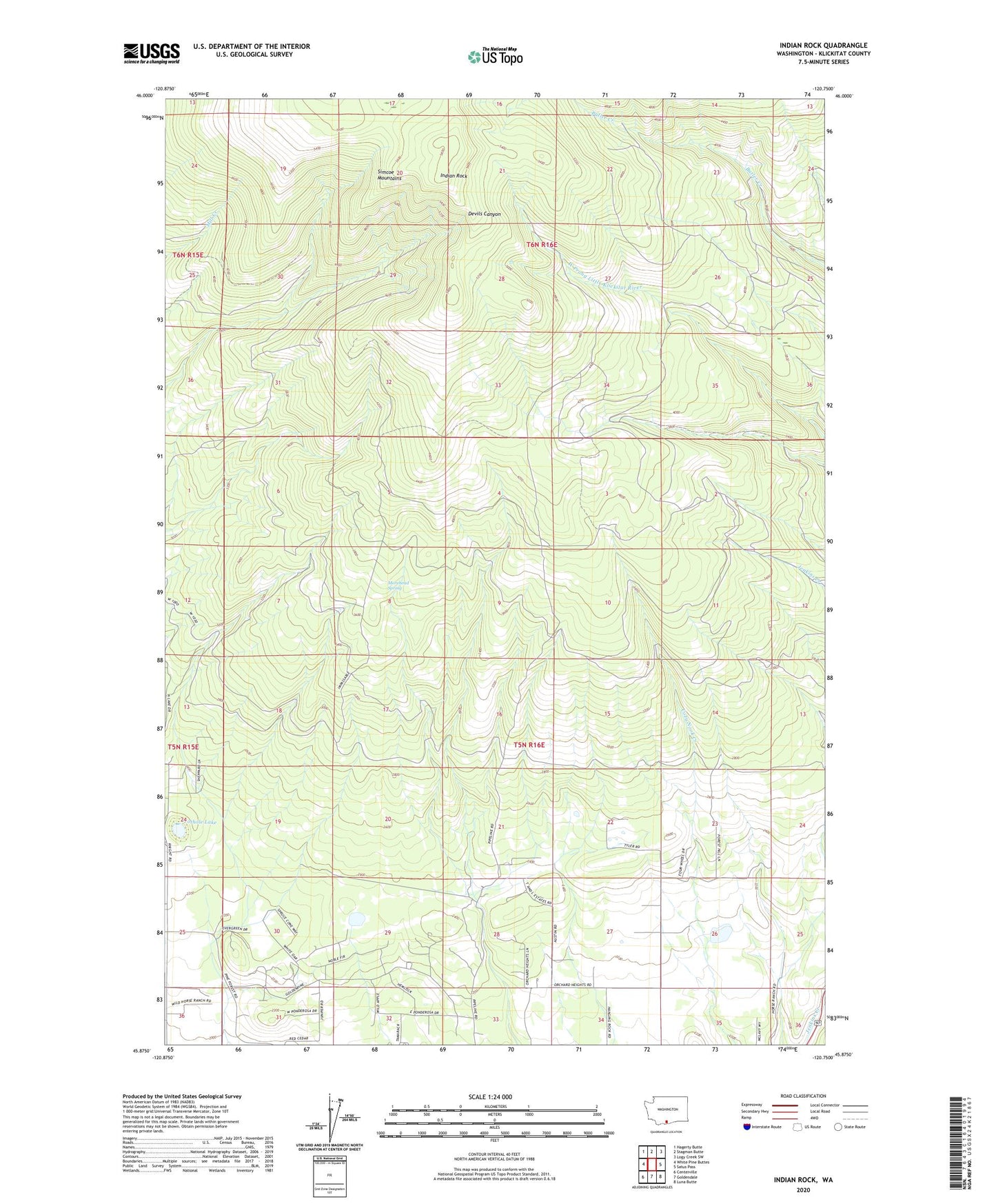
2023 topographic map quadrangle Indian Rock in the state of Washington. Scale: 1:24000. Based on the newly updated USGS 7.5' US Topo map series, this map is in the following counties: Klickitat. The map contains contour data, water features, and other items you are used to seeing on USGS maps, but also has updated roads and other features. This is the next generation of topographic maps. Printed on high-quality waterproof paper with UV fade-resistant inks.
Quads adjacent to this one:
West: White Pine Buttes
Northwest: Hagerty Butte
North: Stagman Butte
Northeast: Logy Creek SW
East: Satus Pass
Southeast: Luna Butte
South: Goldendale
Southwest: Centerville
This map covers the same area as the classic USGS quad with code o45120h7.
Contains the following named places: Indian Rock, Morehead Spring, Orchard Heights School, Pine Forest School, Pothole Lake, San Refugio Ranch Dam