MyTopo
Havillah Washington US Topo Map
Couldn't load pickup availability
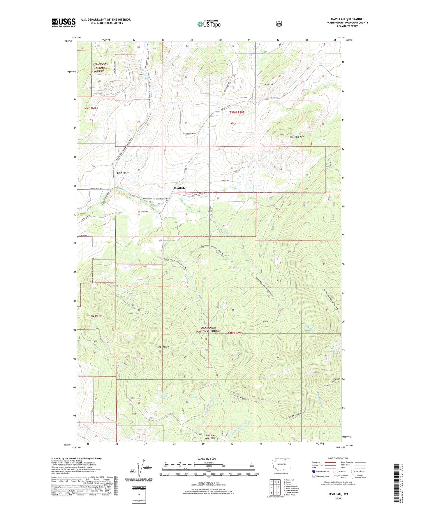
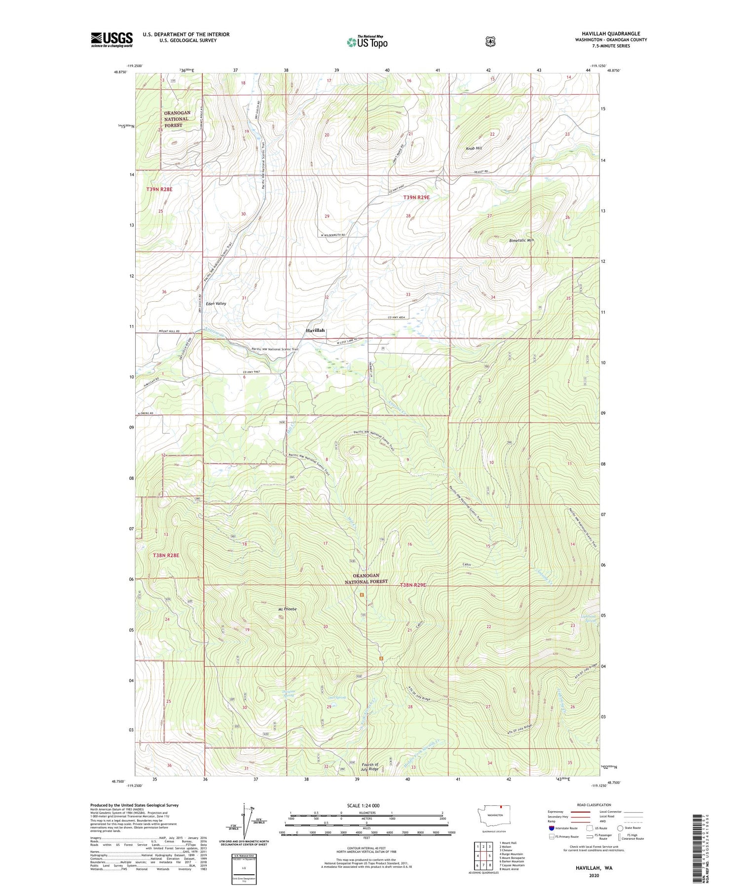
2020 topographic map quadrangle Havillah in the state of Washington. Scale: 1:24000. Based on the newly updated USGS 7.5' US Topo map series, this map is in the following counties: Okanogan. The map contains contour data, water features, and other items you are used to seeing on USGS maps, but also has updated roads and other features. This is the next generation of topographic maps. Printed on high-quality waterproof paper with UV fade-resistant inks.
Quads adjacent to this one:
West: Burge Mountain
Northwest: Mount Hull
North: Molson
Northeast: Chesaw
East: Mount Bonaparte
Southeast: Mount Annie
South: Cayuse Mountain
Southwest: Barker Mountain
Contains the following named places: Antoine Trail, Bimetalic Mountain, Division Spring, Eden Valley, Fourth of July Ridge, Havillah, Highlands, Knob Hill, Lightning Spring, Mill Creek, Mill Creek Trail, Mount Phoebe, Owl Spring