MyTopo
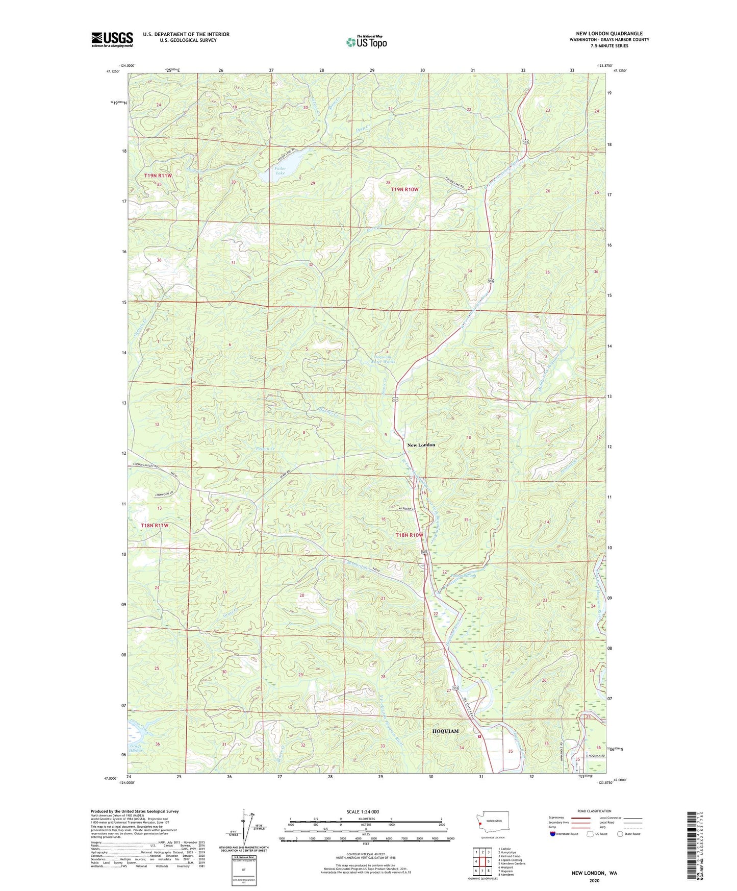
New London Washington US Topo Map
Couldn't load pickup availability
2023 topographic map quadrangle New London in the state of Washington. Scale: 1:24000. Based on the newly updated USGS 7.5' US Topo map series, this map is in the following counties: Grays Harbor. The map contains contour data, water features, and other items you are used to seeing on USGS maps, but also has updated roads and other features. This is the next generation of topographic maps. Printed on high-quality waterproof paper with UV fade-resistant inks.
Quads adjacent to this one:
West: Copalis Crossing
Northwest: Carlisle
North: Humptulips
Northeast: Railroad Camp
East: Aberdeen Gardens
Southeast: Aberdeen
South: Hoquiam
Southwest: Westport
This map covers the same area as the classic USGS quad with code o47123a8.
Contains the following named places: Bernard Creek, Davis Creek, Davis Creek Dam, Deep Creek Lookout, Failor Lake, Failor Lake Dam, Grays Harbor Fire District 6, Hooner Creek, Hoquiam Water Works, Junction Creek, Middle Fork Hoquiam River, Nelson Creek, New London, Polson, Polson Creek, Polson Slough, Shaw Creek, West Fork Hoquiam River, Woodlawn, ZIP Code: 98550