MyTopo
Copalis Crossing Washington US Topo Map
Couldn't load pickup availability
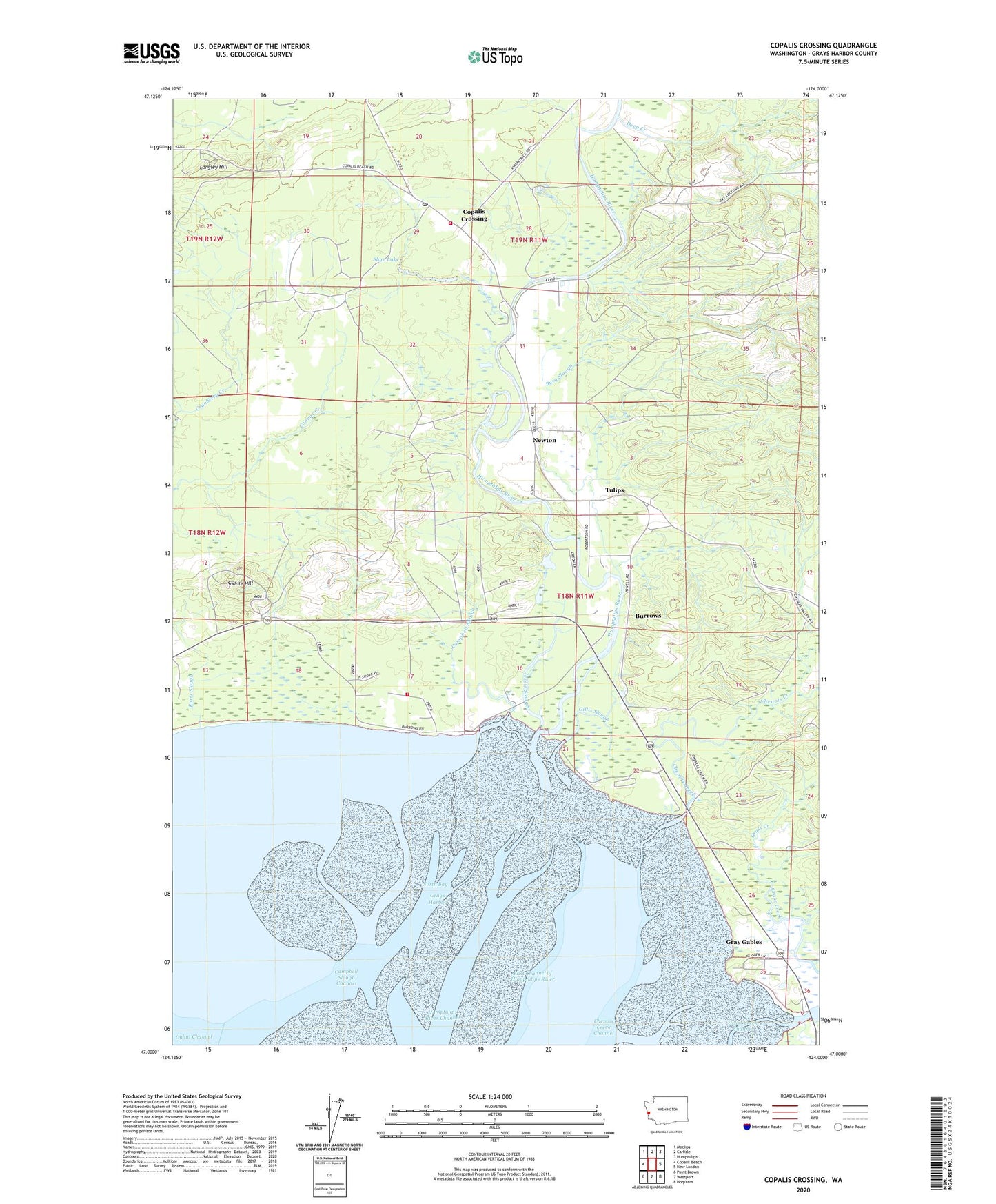
2023 topographic map quadrangle Copalis Crossing in the state of Washington. Scale: 1:24000. Based on the newly updated USGS 7.5' US Topo map series, this map is in the following counties: Grays Harbor. The map contains contour data, water features, and other items you are used to seeing on USGS maps, but also has updated roads and other features. This is the next generation of topographic maps. Printed on high-quality waterproof paper with UV fade-resistant inks.
Quads adjacent to this one:
West: Copalis Beach
Northwest: Moclips
North: Carlisle
Northeast: Humptulips
East: New London
Southeast: Hoquiam
South: Westport
Southwest: Point Brown
This map covers the same area as the classic USGS quad with code o47124a1.
Contains the following named places: Burg Slough, Burrows, Campbell Slough, Campbell Slough Channel, Campbell Slough Dam, Chenois Creek, Copalis Crossing, Copalis Crossing Assembly of God Church, Copalis Crossing Post Office, Copalis Station, Deep Creek, East Channel of Humptulips River, Gillis Slough, Grass Creek, Gray Gables, Grays Harbor Fire District 16 Copalis Crossing Fire Station, Grays Harbor Fire District 7 Station 3 Hoquiam, Humptulips River, Humptulips River Channel, Jessie Slough, Kurtz Slough, Langley Hill, Newton, Saddle Hill, Sea Horse Ranch Dike Dam, Shye Lake, Tulips, Wilderness