MyTopo
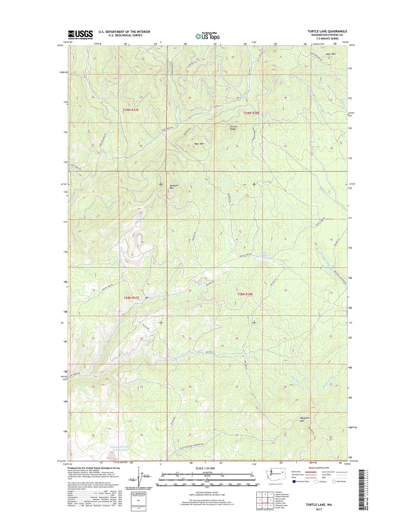
Turtle Lake Washington US Topo Map
Couldn't load pickup availability
2023 topographic map quadrangle Turtle Lake in the state of Washington. Scale: 1:24000. Based on the newly updated USGS 7.5' US Topo map series, this map is in the following counties: Stevens. The map contains contour data, water features, and other items you are used to seeing on USGS maps, but also has updated roads and other features. This is the next generation of topographic maps. Printed on high-quality waterproof paper with UV fade-resistant inks.
Quads adjacent to this one:
West: McCoy Lake
Northwest: Hunters
North: Adams Mountain
Northeast: Empey Mountain
East: Wellpinit
Southeast: Little Falls
South: Benjamin Lake
Southwest: Inkster Lake
This map covers the same area as the classic USGS quad with code o47118h1.
Contains the following named places: Bear Mountain, Blue Creek Camp, Deer Mountain, Germania Consolidated Mine, Grouse Ridge, Midnight Mine, Owl Creek, Oyachen Creek, Rail Creek, Sherwood Project Tailings Dam, Spokane Mountain, Spokane Reservation, Spokane Reservation Division, Turtle Lake, Wellpinit Mountain, ZIP Code: 99040