MyTopo
Inchelium Washington US Topo Map
Couldn't load pickup availability
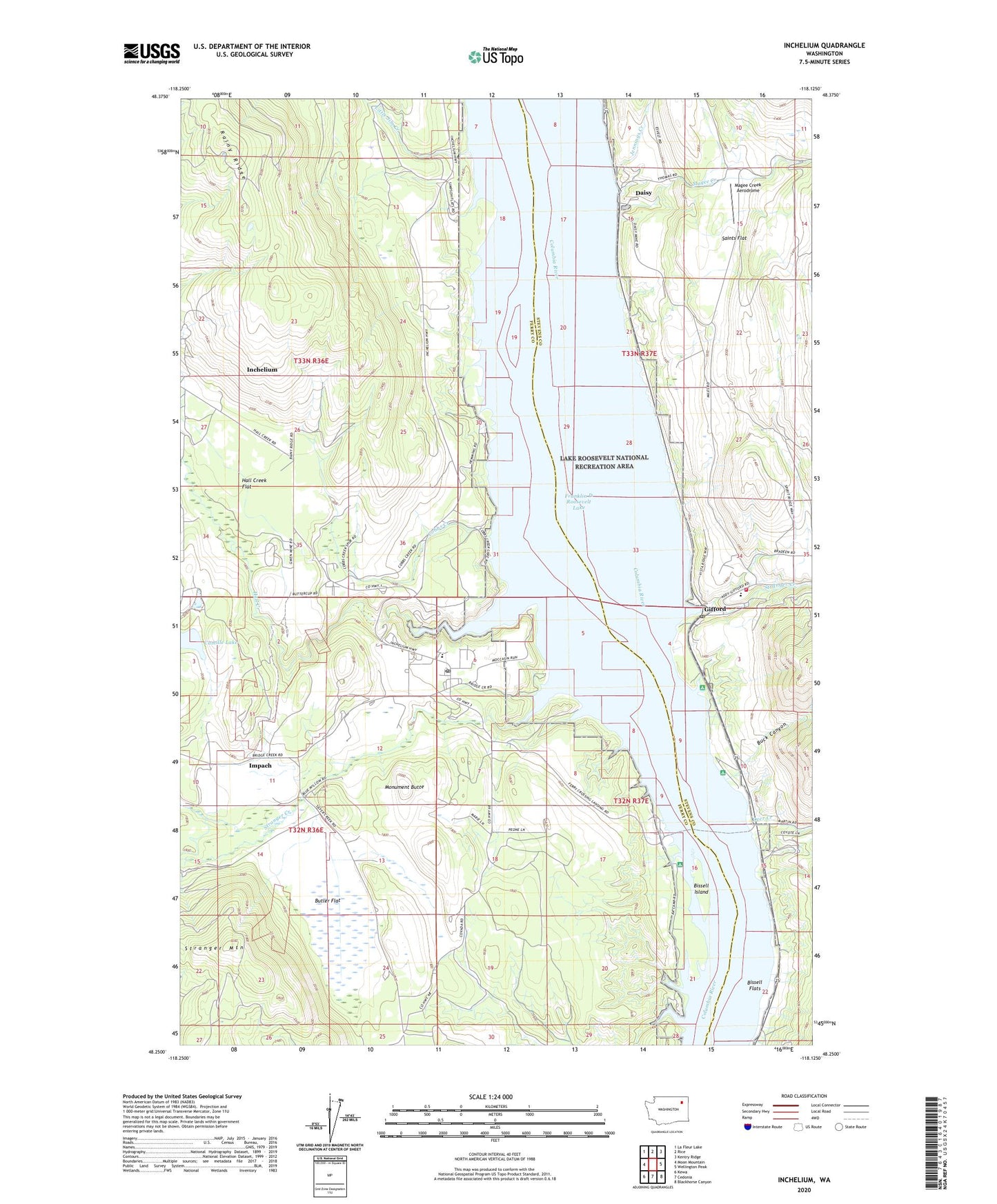
2020 topographic map quadrangle Inchelium in the state of Washington. Scale: 1:24000. Based on the newly updated USGS 7.5' US Topo map series, this map is in the following counties: Ferry, Stevens. The map contains contour data, water features, and other items you are used to seeing on USGS maps, but also has updated roads and other features. This is the next generation of topographic maps. Printed on high-quality waterproof paper with UV fade-resistant inks.
Quads adjacent to this one:
West: Moon Mountain
Northwest: La Fleur Lake
North: Rice
Northeast: Kentry Ridge
East: Wellington Peak
Southeast: Blackhorse Canyon
South: Cedonia
Southwest: Kewa
Contains the following named places: Bissell Flats, Bissell Island, Buck Canyon, Butler Flat, Camille Lake, Cloverleaf Beach Campground, Cobbs Creek, Colville Indian Subagency, Daisy, Deer Creek, Edendale, Evergreen Elementary School, Gifford, Gifford Campground, Gifford Ferry Landing, Gifford Post Office, Guinn Mine, Hall Creek, Hall Creek Flat, Impach, Inchelium, Inchelium Census Designated Place, Inchelium Elementary School, Inchelium Ferry Landing, Inchelium High School, Inchelium Middle School, Inchelium Post Office, Inchelium School District Number 70, Jennings Creek, Little Jim Creek, Magee Creek, Magee Creek Aerodrome, Monument Butte, Saints Flat, Stevens County Fire District 12 Station 121, Stranger Creek, Stranger Mountain, Ward School, ZIP Code: 99131