MyTopo
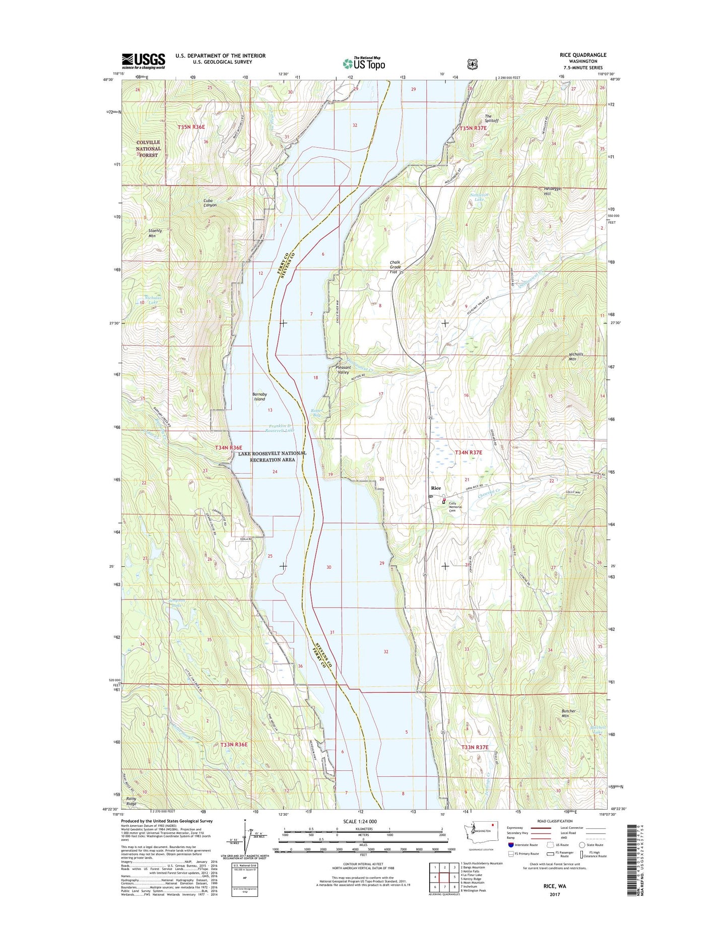
Rice Washington US Topo Map
Couldn't load pickup availability
Also explore the Rice Forest Service Topo of this same quad for updated USFS data
2023 topographic map quadrangle Rice in the state of Washington. Scale: 1:24000. Based on the newly updated USGS 7.5' US Topo map series, this map is in the following counties: Stevens, Ferry. The map contains contour data, water features, and other items you are used to seeing on USGS maps, but also has updated roads and other features. This is the next generation of topographic maps. Printed on high-quality waterproof paper with UV fade-resistant inks.
Quads adjacent to this one:
West: La Fleur Lake
Northwest: South Huckleberry Mountain
North: Bangs Mountain
Northeast: Kettle Falls
East: Kentry Ridge
Southeast: Wellington Peak
South: Inchelium
Southwest: Moon Mountain
This map covers the same area as the classic USGS quad with code o48118d2.
Contains the following named places: Barnaby Creek, Barnaby Island, Big Lake Mine, Cedar Creek, Chalk Grade Flat, Cheweka Creek, Cuba Canyon, Cully Memorial Cemetery, Harvey, La Fleur Creek, Mitchell Lake, Nettleton Lake, Nicholas Lake, Nicholls Mountain, Old Copper Hill, Pleasant Valley, Quillisascut Creek, Rice, Rice Post Office, Rotter Bay, Simpson Lake, Staehly Mountain, Staehly Ranch, Stahley Lookout, Stevens County Fire District 12 Rice, The Splitoff, Victory Baptist Church