MyTopo
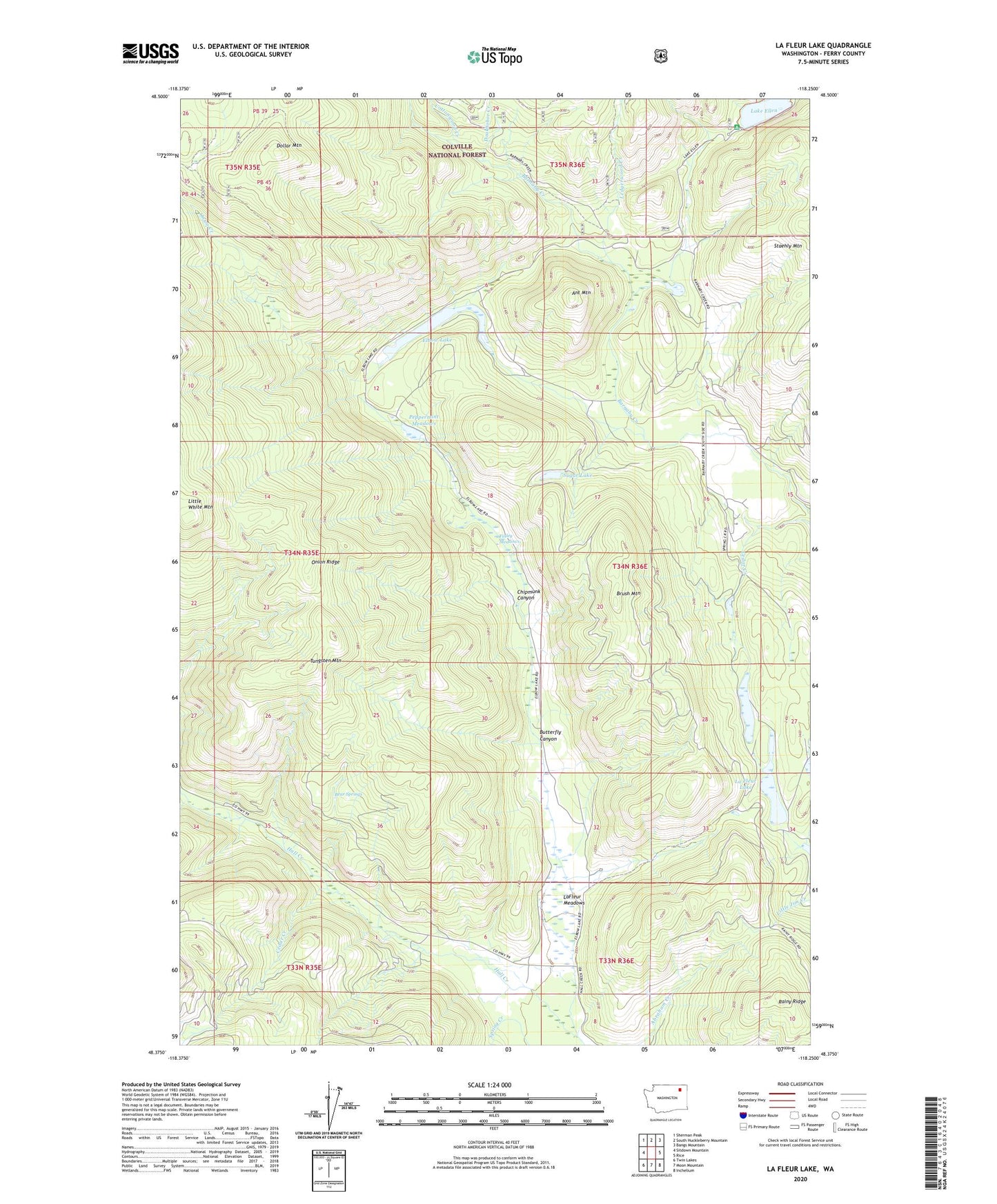
La Fleur Lake Washington US Topo Map
Couldn't load pickup availability
Also explore the La Fleur Lake Forest Service Topo of this same quad for updated USFS data
2023 topographic map quadrangle La Fleur Lake in the state of Washington. Scale: 1:24000. Based on the newly updated USGS 7.5' US Topo map series, this map is in the following counties: Ferry. The map contains contour data, water features, and other items you are used to seeing on USGS maps, but also has updated roads and other features. This is the next generation of topographic maps. Printed on high-quality waterproof paper with UV fade-resistant inks.
Quads adjacent to this one:
West: Sitdown Mountain
Northwest: Sherman Peak
North: South Huckleberry Mountain
Northeast: Bangs Mountain
East: Rice
Southeast: Inchelium
South: Moon Mountain
Southwest: Twin Lakes
This map covers the same area as the classic USGS quad with code o48118d3.
Contains the following named places: Ant Mountain, Banning Ranch, Bear Springs, Brush Mountain, Butterfly Canyon, Cedar Creek, Chief Barnaby Ranch, Chipmunk Canyon, Cottonwood Creek, Dollar Mountain, Doukhobor Creek, Elbow Lake, Elbow Lake Campground, Finley Meadows, La Fleur Lake, LaFleur Meadows, Lake Ellen, Ledgerwood Creek, Nicolas Ranch, Onion Creek, Peppermint Meadows, Rainy Ridge, Sugar Lake, Tungsten Mountain