MyTopo
La Push Washington US Topo Map
Couldn't load pickup availability
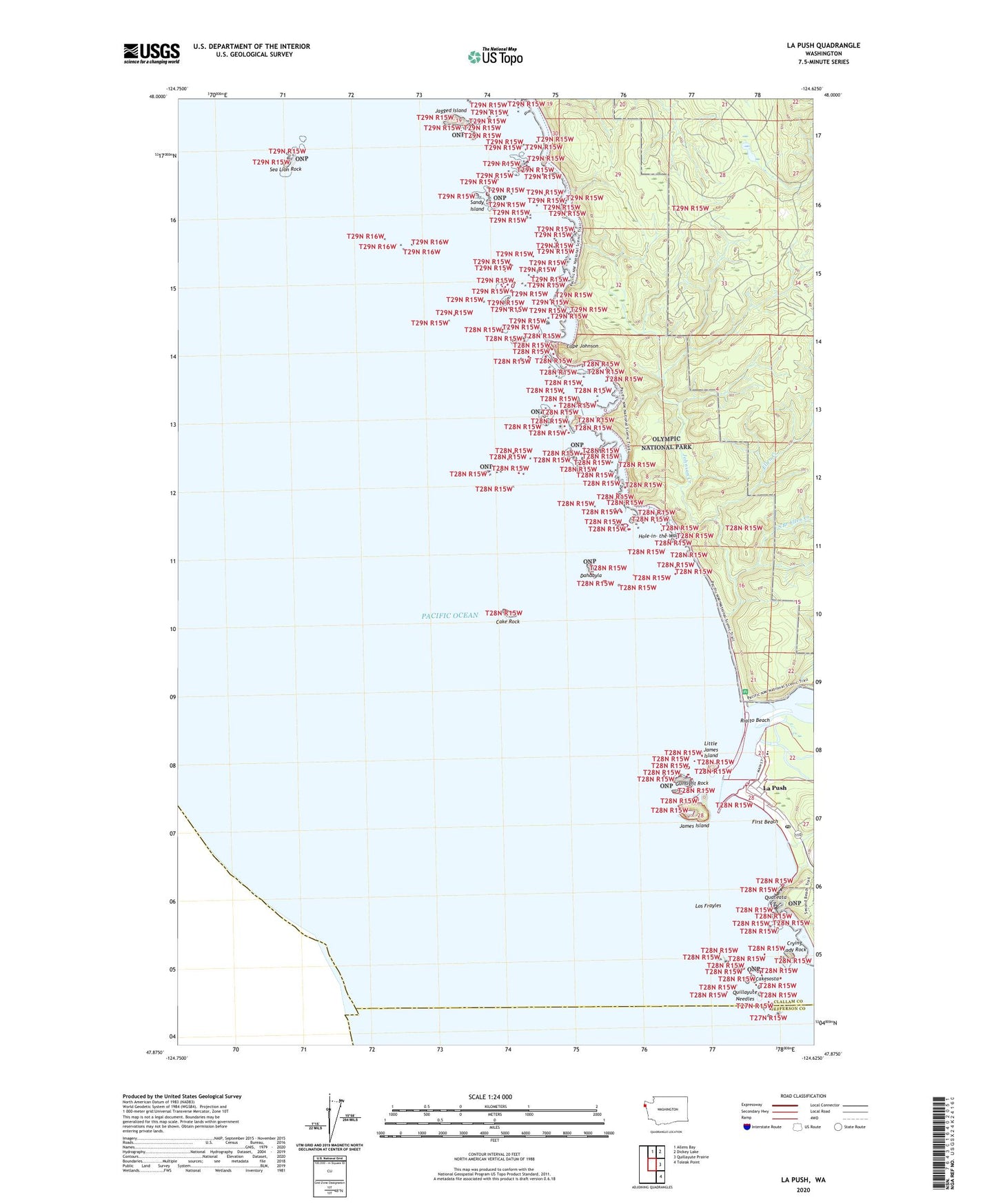
2023 topographic map quadrangle La Push in the state of Washington. Scale: 1:24000. Based on the newly updated USGS 7.5' US Topo map series, this map is in the following counties: Clallam, Jefferson. The map contains contour data, water features, and other items you are used to seeing on USGS maps, but also has updated roads and other features. This is the next generation of topographic maps. Printed on high-quality waterproof paper with UV fade-resistant inks.
Quads adjacent to this one:
North: Allens Bay
Northeast: Dickey Lake
East: Quillayute Prairie
Southeast: Toleak Point
This map covers the same area as the classic USGS quad with code o47124h6.
Contains the following named places: Cake Rock, Cakesosta, Cape Johnson, Chilean Memorial Monument, Crying Lady Rock, Dahdayla, Ellen Creek, First Beach, Gunsight Rock, Hole-in-the-Wall, Jagged Island, James Island, Johnson Creek, La Push, La Push Assembly of God Church, La Push Post Office, Little James Island, Los Frayles, Quateata, Quileute Marina, Quileute Tribal School, Quillayute Needles, Quillayute River, Rialto Beach, Rialto Beach Picnic Area, Sandy Island, Sea Lion Rock, South Branch Ellen Creek