MyTopo
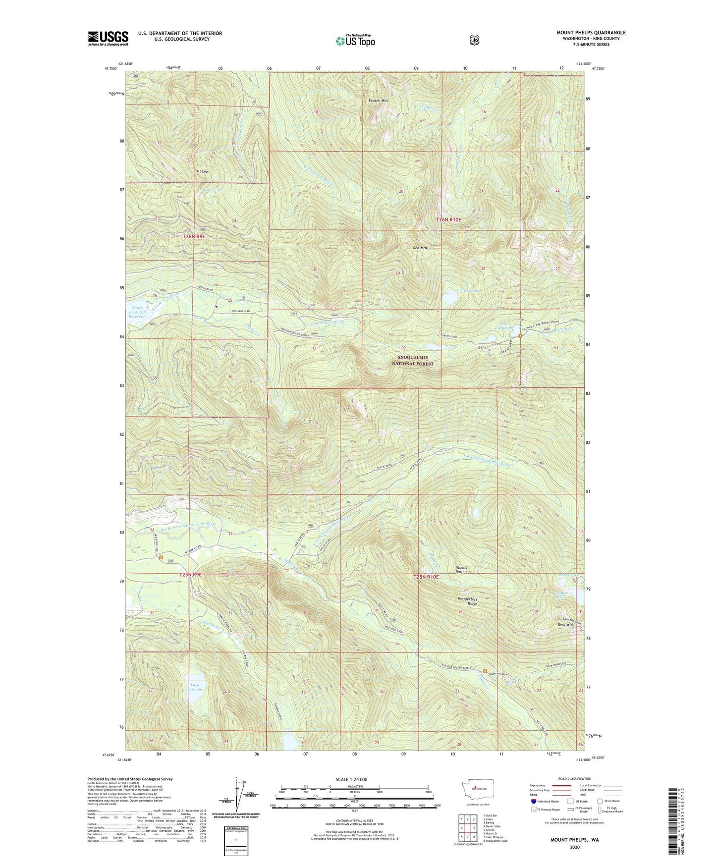
Mount Phelps Washington US Topo Map
Couldn't load pickup availability
Also explore the Mount Phelps Forest Service Topo of this same quad for updated USFS data
2023 topographic map quadrangle Mount Phelps in the state of Washington. Scale: 1:24000. Based on the newly updated USGS 7.5' US Topo map series, this map is in the following counties: King. The map contains contour data, water features, and other items you are used to seeing on USGS maps, but also has updated roads and other features. This is the next generation of topographic maps. Printed on high-quality waterproof paper with UV fade-resistant inks.
Quads adjacent to this one:
West: Devils Slide
Northwest: Gold Bar
North: Index
Northeast: Baring
East: Grotto
Southeast: Snoqualmie Lake
South: Lake Philippa
Southwest: Mount Si
This map covers the same area as the classic USGS quad with code o47121f5.
Contains the following named places: Apex Mine, Bare Mountain, Bare Mountain Lookout, Bear Creek, Beaverdale Mine, Bench Lake, Blackhawk Mine, Cougar Creek, Crater Lake, Damon Mine, Frozen Mountain, Illinois Basin, Illinois Creek, Lake Elizabeth, Lennox Creek, Lennox Mines, Loch Katrine, Mount Lee, Mount Phelps, Paradise Lakes, Phelps Creek, Prospectors Ridge, Red Mountain, Salmon Creek, South Fork Tolt Watershed, Sunday Lake, Titicaed Creek, Titicaed Lake