MyTopo
Latah Washington US Topo Map
Couldn't load pickup availability
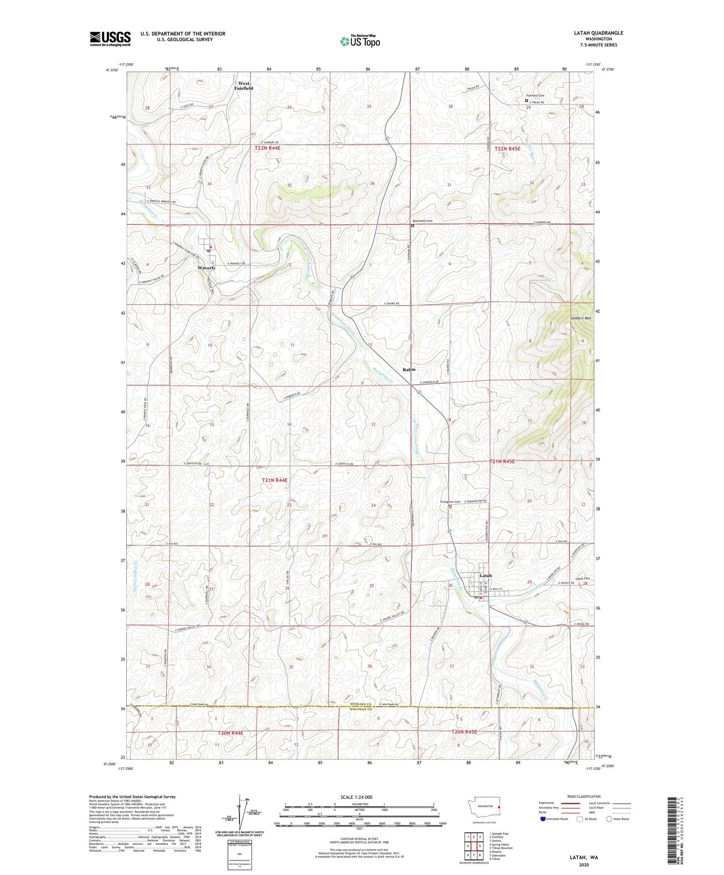
2023 topographic map quadrangle Latah in the state of Washington. Scale: 1:24000. Based on the newly updated USGS 7.5' US Topo map series, this map is in the following counties: Spokane, Whitman. The map contains contour data, water features, and other items you are used to seeing on USGS maps, but also has updated roads and other features. This is the next generation of topographic maps. Printed on high-quality waterproof paper with UV fade-resistant inks.
Quads adjacent to this one:
West: Spring Valley
Northwest: Spangle East
North: Fairfield
Northeast: Setters
East: Tekoa Mountain
Southeast: Tekoa
South: Oakesdale
Southwest: Rosalia
This map covers the same area as the classic USGS quad with code o47117c2.
Contains the following named places: Cove Creek, Curlew, Evergreen Cemetery, Fairfield Cemetery, Gelbert Mountain, Jefferson, Latah, Latah Cemetery, Latah Post Office, Rahm, Rosewood Cemetery, Spokane County Fire District 12, Town of Latah, Town of Waverly, Waverly, Waverly Post Office, West Fairfield, ZIP Code: 99018