MyTopo
Tekoa Washington US Topo Map
Couldn't load pickup availability
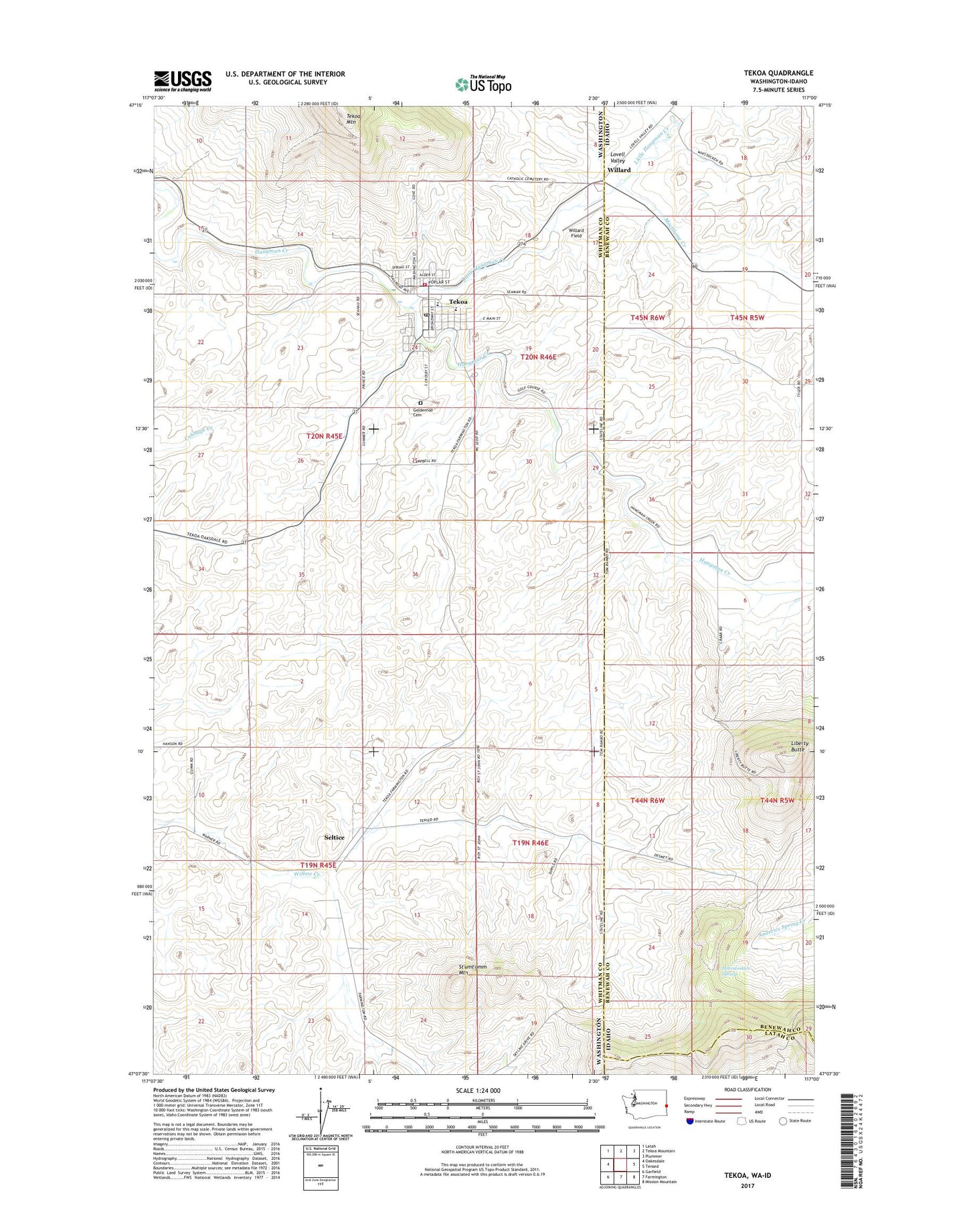
2023 topographic map quadrangle Tekoa in the states of Washington, Idaho. Scale: 1:24000. Based on the newly updated USGS 7.5' US Topo map series, this map is in the following counties: Whitman, Benewah, Latah. The map contains contour data, water features, and other items you are used to seeing on USGS maps, but also has updated roads and other features. This is the next generation of topographic maps. Printed on high-quality waterproof paper with UV fade-resistant inks.
Quads adjacent to this one:
West: Oakesdale
Northwest: Latah
North: Tekoa Mountain
Northeast: Plummer
East: Tensed
Southeast: Mission Mountain
South: Farmington
Southwest: Garfield
This map covers the same area as the classic USGS quad with code o47117b1.
Contains the following named places: City of Tekoa, Goldenrod Cemetery, Hn(os(oskwe' Spring, Hnchdmine'kwe', Liberty Butte, Little Hangman Creek, Lovell Valley, Moctileme Creek, Seltice, St'umt'umm Mountain, Tekoa, Tekoa Ambulance Service, Tekoa Division, Tekoa Fire Department, Tekoa Post Office, Tilmo, Whittman County Sheriff Department Tekoa, Willard, Willard Field, ZIP Code: 99033